geo.wikisort.org - Montagne
Le pic Castle est une montagne d'une altitude de 3 601 m d'altitude qui est le point culminant des monts White Cloud, dans l’État de l'Idaho aux États-Unis.
Pour les articles homonymes, voir Pic Castle.
Cet article est une ébauche concernant la montagne et l’Idaho.
Vous pouvez partager vos connaissances en l’améliorant (comment ?) selon les recommandations des projets correspondants.
| Pic Castle | |||
 Vue du pic Castle. | |||
| Géographie | |||
|---|---|---|---|
| Altitude | 3 601 m[1] | ||
| Massif | Monts White Cloud (montagnes Rocheuses) | ||
| Coordonnées | 44° 02′ 22″ nord, 114° 35′ 07″ ouest[1] | ||
| Administration | |||
| Pays | |||
| État | Idaho | ||
| Comté | Custer | ||
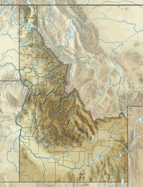
| Géolocalisation sur la carte : Idaho
Géolocalisation sur la carte : États-Unis
| |||
| modifier |
|||

Notes et références
- (en) Cet article est partiellement ou en totalité issu de l’article de Wikipédia en anglais intitulé « Castle Peak (Idaho) » (voir la liste des auteurs).
- Visualisation sur l'USGS.
Liens externes
- Ressources relatives à la géographie :
 Portail de la montagne
  Portail de l’Idaho
На других языках
[en] Castle Peak (Idaho)
Castle Peak (11,815 feet (3,601 m)) is a mountain in the western United States, the highest peak in the White Cloud Mountains of central Idaho and the Idaho Batholith. Located in Custer County, it is the 25th highest peak in the state, and the ninth most prominent.[2][3]- [fr] Pic Castle (Idaho)
Текст в блоке "Читать" взят с сайта "Википедия" и доступен по лицензии Creative Commons Attribution-ShareAlike; в отдельных случаях могут действовать дополнительные условия.
Другой контент может иметь иную лицензию. Перед использованием материалов сайта WikiSort.org внимательно изучите правила лицензирования конкретных элементов наполнения сайта.
Другой контент может иметь иную лицензию. Перед использованием материалов сайта WikiSort.org внимательно изучите правила лицензирования конкретных элементов наполнения сайта.
2019-2026
WikiSort.org - проект по пересортировке и дополнению контента Википедии
WikiSort.org - проект по пересортировке и дополнению контента Википедии