geo.wikisort.org - Montagne
Le Patilla Pata est un stratovolcan bolivien. La date de sa dernière éruption est inconnue, mais elle est apparemment antérieure à l'Holocene la montagne possédant une importante couche de glace. La composition du volcan est principalement andésitique, mais on trouve également des coulées de lave basaltique.
Cet article est une ébauche concernant le volcanisme, la Bolivie et la montagne.
Vous pouvez partager vos connaissances en l’améliorant (comment ?) selon les recommandations des projets correspondants.
| Patilla Pata | ||
 Vue satellite du Patilla Pata (centre gauche). | ||
| Géographie | ||
|---|---|---|
| Altitude | 5 415 m | |
| Massif | Cordillère Occidentale (Andes) | |
| Coordonnées | 18° 02′ 13″ sud, 69° 01′ 59″ ouest | |
| Administration | ||
| Pays | ||
| Département | Oruro | |
| Province | Sajama | |
| Géologie | ||
| Roches | Andésite, basalte | |
| Type | Volcan de subduction | |
| Activité | Inconnue | |
| Dernière éruption | Inconnue | |
| Code GVP | Aucun | |
| Observatoire | Aucun | |
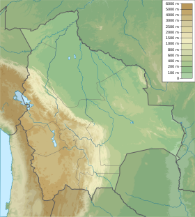
| Géolocalisation sur la carte : Bolivie
| ||
| modifier |
||
Lien externe
 Portail du volcanisme
  Portail de la Bolivie
  Portail de la montagne
На других языках
[en] Patilla Pata
Patilla Pata is a stratovolcano in the Oruro Department in Bolivia. It is situated in the Sajama Province, in the west of the Curahuara de Carangas Municipality, at the border with Chile. Patilla Pata lies south-west of the mountain Jisk'a Kunturiri, north-east of the lake Q'asiri Quta (Khasiri Kkota) and the mountain Qullqi Warani, west of the little lake Sura Pata, south-east of the mountains Laram Q'awa, Kunturiri and Milluni and south of the little lake named Ch'iyar Quta.- [fr] Patilla Pata
Текст в блоке "Читать" взят с сайта "Википедия" и доступен по лицензии Creative Commons Attribution-ShareAlike; в отдельных случаях могут действовать дополнительные условия.
Другой контент может иметь иную лицензию. Перед использованием материалов сайта WikiSort.org внимательно изучите правила лицензирования конкретных элементов наполнения сайта.
Другой контент может иметь иную лицензию. Перед использованием материалов сайта WikiSort.org внимательно изучите правила лицензирования конкретных элементов наполнения сайта.
2019-2025
WikiSort.org - проект по пересортировке и дополнению контента Википедии
WikiSort.org - проект по пересортировке и дополнению контента Википедии