geo.wikisort.org - Montagne
Odaesan (오대산) est une montagne de la province de Gangwon en Corée du Sud à la jonction des districts de Gangneung, Pyeongchang et Hongcheon. Elle culmine à 1 563 mètres d'altitude dans les monts Taebaek. Le nom Odaesan signifie « montagne des cinq plaines » et fait référence aux cinq hauts plateaux placés entre ses cinq sommets. Le plus grand de ces cinq pics est le Birobong (비로봉). Elle est située au cœur du parc national d'Odaesan fondé en 1975.

Cet article est une ébauche concernant la montagne et la Corée du Sud.
Vous pouvez partager vos connaissances en l’améliorant (comment ?) selon les recommandations des projets correspondants.
| Odaesan | ||
 |
||
| Géographie | ||
|---|---|---|
| Altitude | 1 563 m, Birobong | |
| Massif | Monts Taebaek | |
| Coordonnées | 37° 47′ 53″ nord, 128° 32′ 35″ est | |
| Administration | ||
| Pays | ||
| Province | Gangwon | |
| Ville Districts |
Gangneung Pyeongchang, Hongcheon |
|
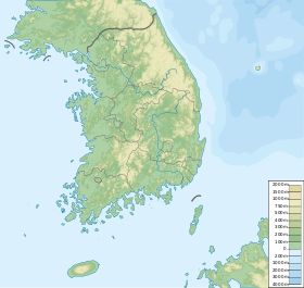
| Géolocalisation sur la carte : Corée du Sud
| ||
| modifier |
||
La montagne d'Odaesan abrite un grand nombre de trésors culturels, en particulier les temples bouddhistes de Woljeongsa et Sangwonsa. De plus, depuis 1606 et jusqu'à la colonisation japonaise, une copie des archives royales, les annales de la dynastie Joseon, était stockée dans ce lieu.
Le , la montagne fut le théâtre d'un tremblement de terre de magnitude 4,6, le séisme le plus important de la décennie dans un pays peu sujet à ce genre de catastrophe naturelle[1].
Lien externe
Références
- (en) Cet article est partiellement ou en totalité issu de l’article de Wikipédia en anglais intitulé « Odaesan » (voir la liste des auteurs).
- (en) « The 20 January 2007 ML 4.8 Odaesan Earthquake and Its Implications for Regional Tectonics in Korea - Kim and Park 100 (3): 1395 - Bulletin of the Seismological Society of America », Bssa.geoscienceworld.org, (DOI 10.1785/0120090234, consulté le )
 Portail de la Corée du Sud
  Portail de la montagne
На других языках
[en] Odaesan
Odaesan, also known as Mount Odae-san or Mount Odae (Korean: 오대산; Hanja: 五臺山), is a major cluster of mountains and national park in eastern Gangwon Province, South Korea, standing at the junction of Gangneung City, Pyeongchang County and Hongcheon County. It stands at the junction of the Taebaek Mountains and the Charyeong Mountains, a spur range stretching to the west and serving to divide the South Han River / Namhan River from the North Han River / Bukhan River. It stands just to the south of Seoraksan and north of Dutasan along the Baekdudaegan Mountain-system mainline, the range of granite peaks that make up the symbolic spine of the Korean Peninsula, but its peaks are more rounded and forested than most. National Highway 6 runs through the park, between the south main-entrance and the northeast corner descending to the east coast. It contain five main peaks surrounding a deep main valley running north to south, and several other subsidiary peaks, such as Noin-bong (see Attractions below), with gorges between, a watershed forming a river leaving this area to the south. Just outside the western boundary of the national park area, another mountain Gyebang-san rises to 1,577 m (5,174 ft), higher than conventional Odae-san's summit, and they are connected by a 10 km long ridge; it is controversial whether or not to include this within the cluster or consider it as separate.- [fr] Odaesan
Другой контент может иметь иную лицензию. Перед использованием материалов сайта WikiSort.org внимательно изучите правила лицензирования конкретных элементов наполнения сайта.
WikiSort.org - проект по пересортировке и дополнению контента Википедии