geo.wikisort.org - Montagne
Le Ngozi est un volcan de Tanzanie qui se présente sous la forme d'une caldeira culminant à 2 622 mètres d'altitude.
Pour les articles homonymes, voir Ngozi.
Cet article est une ébauche concernant la montagne et le volcanisme.
Vous pouvez partager vos connaissances en l’améliorant (comment ?) selon les recommandations des projets correspondants.
| Ngozi | ||
 Vue partielle de la caldeira du Ngozi. | ||
| Localisation | ||
|---|---|---|
| Coordonnées | 8° 58′ S, 33° 34′ E | |
| Pays | ||
| Géologie | ||
| Massif | Vallée du Grand Rift | |
| Type de cratère | Caldeira | |
| Type | Volcan de rift | |
| Activité | Inconnue | |
| Dernière éruption | inconnue | |
| Code GVP | 222164 | |
| Observatoire | Aucun | |
| Dimensions | ||
| Altitude | 2 622 m | |
| Longueur | 2,5 km | |
| Largeur | 1,5 km | |
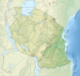
| Géolocalisation sur la carte : Tanzanie
| ||
| modifier |
||
La caldeira, dont les parois hautes de 150 à 300 mètres sont formées par des phonolites et des trachytes, a une largeur de 1,5 kilomètre et une longueur de 2,5 kilomètres et est occupée par un lac.
Source
 Portail de la Tanzanie
  Portail de la montagne
  Portail du volcanisme
На других языках
[de] Ngozi (Berg)
Der Ngozi, auch Ngosi geschrieben, ist ein zuletzt um 1450 ausgebrochener Vulkan mit einer Caldera in den Poroto-Bergen im südlichen Hochland von Tansania. Es existiert ein imposanter Krater, der ein beliebtes Wanderziel von der Stadt Mbeya aus ist. In der Caldera gibt es einen 1,5 mal 2,5 Kilometer großen Kratersee.[en] Lake Ngozi
Lake Ngozi (or Lake Ngosi[1]) is the second largest crater lake in Africa.[2] It can be found near Tukuyu, a small town in the highland Rungwe District, Mbeya Region, of southern Tanzania in East Africa. It is part of the Poroto Mountains and the northern rim of the caldera is the highest point in the range. The caldera mostly composed from trachytic and phonolitic lavas. Ngozi is a Holocene caldera that generated the Kitulo pumice 12,000 years ago during a Plinian eruption, most likely in the same eruption that generated the caldera. Other eruption deposits are the Ngozi Tuff (less than thousand years ago) and the Ituwa Surge base surge deposits of uncertain age, but intermediary to the Kitulo pumice and Ngozi Tuff. The youngest activity generated a pyroclastic flow that flowed southwards for 10 km around 1450 CE. Some pyroclastic cones surround the volcano. The walls of the caldera are forested, with the exception of segments scoured by landslides and high cliffs that inhibit access to the water. The inner caldera is forested with Maesa lanceolata, Albizia gummifera and Hagenia abyssinica, far fewer tree species than neighbouring mountains consistent with the recent geological origin of the volcano. The caldera itself is not subjected to hydrothermal activity, but large subaqueous CO2 emissions and local legends of the killing power of the lake indicate a danger of limnic eruptions. The lake floor according to echosounding is flat and has no terraces.[3][4][5]- [fr] Ngozi (Tanzanie)
[it] Lago Ngozi
Il lago Ngozi è il secondo maggiore lago craterico dell'Africa.[1] Si trova nei pressi di Tukuyu, una piccola cittadina sulle colline del distretto di Rungwe, nella regione di Mbeya, della Tanzania meridionale. Si trova all'interno della catena dei monti Poroto, a loro volta parte settentrionale dei monti Kipengere e un bordo della caldera costituisce la vetta più elevata della catena.Текст в блоке "Читать" взят с сайта "Википедия" и доступен по лицензии Creative Commons Attribution-ShareAlike; в отдельных случаях могут действовать дополнительные условия.
Другой контент может иметь иную лицензию. Перед использованием материалов сайта WikiSort.org внимательно изучите правила лицензирования конкретных элементов наполнения сайта.
Другой контент может иметь иную лицензию. Перед использованием материалов сайта WikiSort.org внимательно изучите правила лицензирования конкретных элементов наполнения сайта.
2019-2025
WikiSort.org - проект по пересортировке и дополнению контента Википедии
WikiSort.org - проект по пересортировке и дополнению контента Википедии