geo.wikisort.org - Montagne
Les monts Uinta (Uinta Mountains) sont une haute chaîne de montagnes des États-Unis, située dans le nord-est de l'Utah (à environ 160 km de Salt Lake City) et extrême nord-ouest du Colorado. Chaine secondaire des montagnes Rocheuses, elle présente la particularité d'être la plus haute chaine américaine (hors Alaska) avec une orientation est-ouest[1]. Ces sommets vont de 3 400 à 4 100 m d'altitude, le plus élevé étant le pic Kings à 4 123 m, point culminant de l'Utah. La Utah State Route 150 (en) (Mirror Lake Highway) traverse la moitié occidentale de la chaine, en direction du Wyoming.
Pour les articles homonymes, voir Uinta.
Cet article est une ébauche concernant la montagne et l’Utah.
Vous pouvez partager vos connaissances en l’améliorant (comment ?) selon les recommandations des projets correspondants.
| Monts Uinta | |
 Carte de localisation des monts Uinta (à l'ouest). | |
| Géographie | |
|---|---|
| Altitude | 4 123 m, Pic Kings |
| Massif | Montagnes Rocheuses |
| Administration | |
| Pays | |
| États | Utah, Colorado |
| Géologie | |
| Âge | 50 à 70 millions d'années |
| Roches | Quartz, schiste et ardoise |
| modifier |
|
Elle se trouve dans l'écorégion de l'EPA appelée Wasatch and Uinta Mountains.
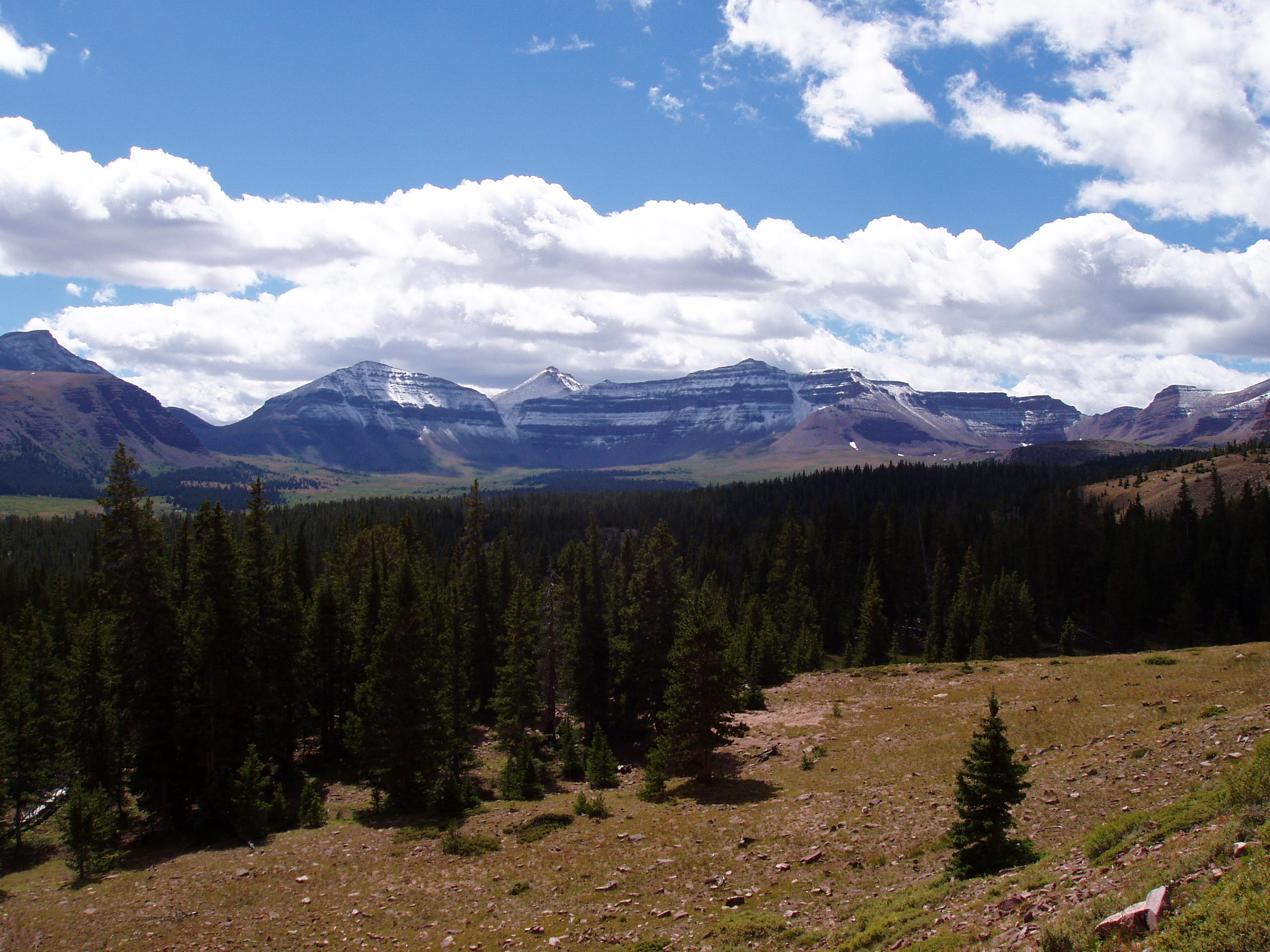
 Vue du pic Kings.
 L'Ute Mountain Fire Tower.

Références
- « Kings Peak, Utah », Peakbagger.com (consulté le )
Bibliographie
- Mel Davis, John Veranth, High Uinta Trails, Salt Lake City, Wasatch Publishers, 1988, 3e édition (ISBN 0915272377)
- Wallace R. Hansen, The Geologic Story of the Uinta Mountains, Washington, DC: U.S. Government Printing Office, 1975
 Portail de la montagne
  Portail du Colorado
  Portail de l’Utah
На других языках
[de] Uinta Mountains
Die Uinta Mountains [.mw-parser-output .IPA a{text-decoration:none}juːˈɪntə ˈmaʊntənz] sind ein Gebirgszug der Rocky Mountains im nordöstlichen Utah (Vereinigte Staaten). Sie verlaufen etwa 160 km östlich von Salt Lake City in einer für dieses Gebirge ungewöhnlichen Ost-West-Richtung und erreichen Gipfelhöhen von etwa 3700 bis 4100 m. Höchste Erhebung ist der Kings Peak, der mit 4124 m Höhe gleichzeitig die höchste Erhebung des Bundesstaats Utah ist.[en] Uinta Mountains
The Uinta Mountains (/juːˈɪntə/ yoo-IN-tə) are an east-west trending chain of mountains in northeastern Utah extending slightly into southern Wyoming in the United States. As a subrange of the Rocky Mountains, they are unusual for being the highest range in the contiguous United States running east to west,[1] and lie approximately 100 miles (160 km) east of Salt Lake City. The range has peaks ranging from 11,000 to 13,528 feet (3,353 to 4,123 m), with the highest point being Kings Peak, also the highest point in Utah. The Mirror Lake Highway crosses the western half of the Uintas on its way to Wyoming.- [fr] Monts Uinta
[it] Monti Uinta
I monti Uinta sono una catena montuosa in direzione est-ovest situata nella parte nord-orientale dello Utah, con una piccola parte che si estende nel sud del Wyoming, negli Stati Uniti. Pur formando una parte delle Montagne Rocciose, ha delle caratteristiche curiose, come ad esempio il fatto di essere la catena montuosa più alta degli Stati Uniti continentali in direzione da est a ovest. Si trovano a circa 160 km a est di Salt Lake City. L'altitudine delle cime varia da 3 353 a 4 123 metri sul livello del mare, e la sua più grande cima è il Kings Peak, che è anche il punto più alto dello Utah. La Mirror Lake Highway attraversa la metà occidentale degli Uinta verso il Wyoming.[ru] Юинта (горы)
Юи́нта[2] (англ. Uinta Mountains) — горный хребет на северо-востоке штата Юта и юге штата Вайоминг, США. Является частью Скалистых гор, а также самым высоким хребтом в континентальных штатах, идущим в направлении с востока на запад[1]. Расположен примерно в 160 км к востоку от города Солт-Лейк-Сити. Высшей точкой хребта является гора Кингс-Пик, высота которой составляет 4123 м[3].Другой контент может иметь иную лицензию. Перед использованием материалов сайта WikiSort.org внимательно изучите правила лицензирования конкретных элементов наполнения сайта.
WikiSort.org - проект по пересортировке и дополнению контента Википедии