geo.wikisort.org - Montagne
Le mont Pavlof, en anglais Mount Pavlof, est un volcan des États-Unis situé en Alaska, dans la péninsule d'Alaska. Culminant à 2 493 mètres d'altitude, il est le volcan le plus actif de l'arc des Aléoutiennes[1] et en éruption depuis le 16 août 2021[3]. Le Pavlof Sister, un autre volcan, est son voisin immédiat.


Cet article est une ébauche concernant l’Alaska, la montagne et le volcanisme.
Vous pouvez partager vos connaissances en l’améliorant (comment ?) selon les recommandations des projets correspondants.
Cet article concerne un volcan en éruption.
Le texte peut changer fréquemment, n’est peut-être pas à jour et peut manquer de recul.
N’hésitez pas à participer en citant vos sources.
La dernière modification de cette page a été faite le 21 janvier 2022 à 20:41.
| Mont Pavlof | |||
 Vue aérienne du mont Pavlof montrant son cratère sommital fumant. | |||
| Géographie | |||
|---|---|---|---|
| Altitude | 2 493 m[1] | ||
| Massif | Chaîne aléoutienne | ||
| Coordonnées | 55° 25′ 02″ nord, 161° 53′ 35″ ouest[2],[1] | ||
| Administration | |||
| Pays | |||
| État | Alaska | ||
| Borough | Aléoutiennes orientales | ||
| Ascension | |||
| Première | 27 juin 1928 par T. A. Jagger, J. Gardiner, O. P. McKinley, P. A. Yatchmenoff et R. H. Stewart | ||
| Voie la plus facile | Face nord-ouest | ||
| Géologie | |||
| Roches | Andésite, andésite basaltique, basalte, picro-basalte | ||
| Type | Volcan de subduction | ||
| Morphologie | Stratovolcan | ||
| Activité | En éruption | ||
| Dernière éruption | depuis le 16 août 2021 | ||
| Code GVP | 312030 | ||
| Observatoire | Observatoire volcanologique d'Alaska | ||
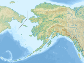
| Géolocalisation sur la carte : États-Unis
Géolocalisation sur la carte : Alaska
| |||
| modifier |
|||

Références
- (en) « Global Volcanism Program - Pavlof » (consulté le )
- Visualisation sur l'USGS.
- « En Alaska, trois volcans ont commencé à entrer en éruption en même temps : les risques de l’événement rare », Netcost Security, (lire en ligne, consulté le )
Liens externes
- Notices dans des dictionnaires ou encyclopédies généralistes :
- Ressources relatives à la géographie :
 Portail de la montagne
  Portail du volcanisme
  Portail de l’Alaska
На других языках
[de] Mount Pavlof
Mount Pavlof ist ein Schichtvulkan auf der Alaska-Halbinsel und liegt am Ufer der Pavlof Bay. Er ist der derzeit aktivste Vulkan der Aleutenkette. Der Gipfelbereich des kegelförmigen Vulkans ist schneebedeckt. Vom Gipfel zieht ein deutlicher Grat Richtung Südwesten zum Rand der Emmons Lake Caldera. Der Vulkankegel misst ungefähr sieben Kilometer im Durchmesser. Nahe dem Gipfelbereich gibt es aktive Schlote an der Nord- und Ostseite.[1] Der Name „Pavlof“ ist russischen Ursprungs und eine Übersetzung von Sankt Paul.[2][en] Mount Pavlof
Pavlof Volcano is a stratovolcano of the Aleutian Range on the Alaska Peninsula. It has been one of the most active volcanoes in the United States since 1980, with eruptions recorded in 1980, 1981, 1983, 1986–1988, 1996–1997, 2007, 2013, twice in 2014, 2016, and is currently erupting as of August 2021.[2][3][4][5] Basaltic andesite with SiO2 around 53% is the most common lava type.[6] The volcano is monitored by the Alaska Volcano Observatory- a joint program of the United States Geological Survey (USGS), the Geophysical Institute of the University of Alaska Fairbanks (UAFGI), and the State of Alaska Division of Geological and Geophysical Surveys (ADGGS). With a threat score of 95,[7] the threat from future eruptions is considered to be high; much of this threat comes from the possibility of disruption of nearby air routes by large releases of ash.[7] The mountain currently has basic real-time monitoring, but the USGS would like to improve instrumentation at the site.[7] The mountain shares a name with the nearby Pavlof Sister, which last erupted in 1786.- [fr] Mont Pavlof
[it] Monte Pavlof
Il monte Pavlof è uno stratovulcano della Catena delle Aleutine nella penisola di Alaska. È stato uno dei vulcani più attivi degli Stati Uniti dal 1980, con eruzioni documentate nel 1980, 1981, 1983, 1986-1988, 1996-1997, 2007, 2013, due volte nel 2014 e più recentemente nel marzo 2016.[2][3][4][5] Il tipo di lava più comune sul vulcano è andesite basaltica con una concentrazione di silice (SiO2) intorno al 53%.[6][ru] Вулкан Павлова
Вулкан Павлова (англ. Pavlof Volcano) — действующий стратовулкан, расположенный вблизи южной оконечности полуострова Аляска. Диаметр вулкана примерно 7 км, активные выходы расположены на северном и восточном склонах около вершины[1]. Вершина вулкана достигает отметки 2518 м[1]. Рядом с вулканом есть вторая вершина, высотой 2142 метра[2], — её называют «Сестра Павлова» (англ. Pavlov Sister).Другой контент может иметь иную лицензию. Перед использованием материалов сайта WikiSort.org внимательно изучите правила лицензирования конкретных элементов наполнения сайта.
WikiSort.org - проект по пересортировке и дополнению контента Википедии