geo.wikisort.org - Montagne
Le mont Lyell (3 997 m) est le point culminant du parc national de Yosemite, dans la Sierra Nevada (Californie, États-Unis). Il se trouve au sud-est de la Cathedral Range et à 1,9 km au nord-ouest du pic Rodgers. Il porte le nom de Charles Lyell, un géologue du XIXe siècle. Le mont abrite le plus grand glacier du Yosemite, le glacier Lyell, qui s'étend sur 65 hectares.
Pour le mont homonyme au Canada, voir Mont Lyell.
| Mont Lyell | |||
 Vue du mont Lyell. | |||
| Géographie | |||
|---|---|---|---|
| Altitude | 3 997 m[1] | ||
| Massif | Chaînon Cathedral (Sierra Nevada) | ||
| Coordonnées | 37° 44′ 22″ nord, 119° 16′ 17″ ouest[1] | ||
| Administration | |||
| Pays | |||
| État | Californie | ||
| Comtés | Madera, Tuolumne | ||
| Ascension | |||
| Première | 1863 par A.T. Tileston | ||
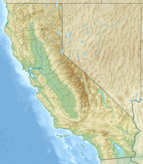
| Géolocalisation sur la carte : États-Unis
Géolocalisation sur la carte : Californie
| |||
| modifier |
|||
Le mont Lyell est à la charnière de plusieurs bassins hydrographiques : au nord, celui de la Tuolumne, à l'ouest celui de la Merced.
Notes et références
- Visualisation sur l'USGS.
Voir aussi
Article connexe
- Le col Donohue se situe au bord de ce sommet
Liens externes
- Ressources relatives à la géographie :
- Portail de la montagne
- Portail du parc national de Yosemite
На других языках
[de] Mount Lyell (Kalifornien)
Der Mount Lyell ist ein 3999 m[2] hoher Berg in der Sierra Nevada im Bundesstaat Kalifornien der Vereinigten Staaten. Er liegt auf der Grenze zwischen Tuolumne County und Madera County im Yosemite-Nationalpark und bildet dessen höchste Erhebung.[1][en] Mount Lyell (California)
Mount Lyell is the highest point in Yosemite National Park, at 13,114 feet (3,997 m). It is located at the southeast end of the Cathedral Range, 1.2 miles (1.9 km) northwest of Rodgers Peak. The peak as well as nearby Lyell Canyon is named after Charles Lyell, a well-known 19th century geologist.[7] The peak had one of the last remaining glaciers in Yosemite, Lyell Glacier. The Lyell Glacier is currently considered to be a permanent ice field, not a living glacier. Mount Lyell divides the Tuolumne River watershed to the north, the Merced to the west, and the Rush Creek drainage in the Mono Lake Basin to the southeast.- [fr] Mont Lyell (Californie)
[ru] Лайелл (гора)
Лайелл (англ. Mount Lyell) — самая высокая вершина Йосемитского национального парка, высотой 3997 м над уровнем моря. Расположена в юго-восточной части хребта Кафедрал, в 1,9 км на северо-запад от пика Роджерса. Названа в честь Чарлза Лайелла, известного геолога XIX века[3]. Вершина имеет крупнейший ледник в Йосемити, ледник Лайелла, вблизи ледника Маклюр на горе Маклюр. Гора Лайелл образует водораздел между рекой Тоулумни (Tuolumne) на севере, Мерсед на западе, и озером Моно на юго-востоке.Текст в блоке "Читать" взят с сайта "Википедия" и доступен по лицензии Creative Commons Attribution-ShareAlike; в отдельных случаях могут действовать дополнительные условия.
Другой контент может иметь иную лицензию. Перед использованием материалов сайта WikiSort.org внимательно изучите правила лицензирования конкретных элементов наполнения сайта.
Другой контент может иметь иную лицензию. Перед использованием материалов сайта WikiSort.org внимательно изучите правила лицензирования конкретных элементов наполнения сайта.
2019-2025
WikiSort.org - проект по пересортировке и дополнению контента Википедии
WikiSort.org - проект по пересортировке и дополнению контента Википедии

