geo.wikisort.org - Montagne
Le mont Kephart (en anglais : Mount Kephart) est un sommet des monts Great Smoky, aux États-Unis. Il culmine à 1 895 mètres d'altitude à la frontière du comté de Swain et du comté de Sevier, respectivement en Caroline du Nord et au Tennessee. Il est protégé au sein du parc national des Great Smoky Mountains.
Cet article est une ébauche concernant la montagne, la Caroline du Nord et le Tennessee.
Vous pouvez partager vos connaissances en l’améliorant (comment ?) selon les recommandations des projets correspondants.
| Mont Kephart | ||||
 Vue depuis l'US 441. | ||||
| Géographie | ||||
|---|---|---|---|---|
| Altitude | 1 895 m[1] | |||
| Massif | Monts Great Smoky (Blue Ridge Mountains, Appalaches) | |||
| Coordonnées | 35° 37′ 52″ nord, 83° 23′ 24″ ouest[1] | |||
| Administration | ||||
| Pays | ||||
| États | Caroline du Nord Tennessee |
|||
| Comtés | Swain Sevier |
|||
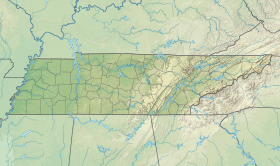
| Géolocalisation sur la carte : États-Unis
Géolocalisation sur la carte : Caroline du Nord
Géolocalisation sur la carte : Tennessee
| ||||
| modifier |
||||


Notes et références
- Visualisation sur l'USGS.
Liens externes
- Ressources relatives à la géographie :
 Portail de la montagne
  Portail de la Caroline du Nord
  Portail du Tennessee
На других языках
[en] Mount Kephart
Mount Kephart is a mountain in the central Great Smoky Mountains, located in the Southeastern United States. The Appalachian Trail crosses the mountain's south slope, making it a destination for thru-hikers. The Jumpoff, a 1,000-foot (300 m) cliff on the northeast side of the mountain, has views of the central and eastern Smokies. A stand of Southern Appalachian spruce-fir forest coats the mountain's upper elevations.- [fr] Mont Kephart
Текст в блоке "Читать" взят с сайта "Википедия" и доступен по лицензии Creative Commons Attribution-ShareAlike; в отдельных случаях могут действовать дополнительные условия.
Другой контент может иметь иную лицензию. Перед использованием материалов сайта WikiSort.org внимательно изучите правила лицензирования конкретных элементов наполнения сайта.
Другой контент может иметь иную лицензию. Перед использованием материалов сайта WikiSort.org внимательно изучите правила лицензирования конкретных элементов наполнения сайта.
2019-2025
WikiSort.org - проект по пересортировке и дополнению контента Википедии
WikiSort.org - проект по пересортировке и дополнению контента Википедии