geo.wikisort.org - Montagne
Le mont Chamberlin est un sommet de la chaîne Brooks, dans le Nord de l’Alaska, aux États-Unis. Il culmine à 2 712 mètres d'altitude.
Cet article est une ébauche concernant l’Alaska et la montagne.
Vous pouvez partager vos connaissances en l’améliorant (comment ?) selon les recommandations des projets correspondants.
| Mont Chamberlin | |||
 |
|||
| Géographie | |||
|---|---|---|---|
| Altitude | 2 712 m[1],[2] | ||
| Massif | Chaîne Brooks | ||
| Coordonnées | 69° 16′ 39″ nord, 144° 54′ 40″ ouest[3] | ||
| Administration | |||
| Pays | |||
| État | Alaska | ||
| Borough | North Slope | ||
| Ascension | |||
| Première | par George G. Barnes, Dennis Burge et Graham Stephenson | ||
| Voie la plus facile | Arête ouest | ||
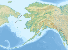
| Géolocalisation sur la carte : Alaska
Géolocalisation sur la carte : États-Unis
| |||
| modifier |
|||

En 2014, une nouvelle technologie de mesure a établi que le mont Isto était le plus haut sommet de la chaîne, alors qu'auparavant on pensait que c'était le mont Chamberlin, maintenant classé troisième.
Voir aussi
Notes et références
- (en) Measuring the highest peaks in the Brooks Range, Geophysical Institute, University of Alaska Fairbanks, 16 décembre 2015.
- (en) Matt Nolan, and Kit DesLauriers, Which are the highest peaks in the US Arctic? Fodar settles the debate, The Cryosphere, vol. 10, 2016, pages 1245–1257, DOI:10.5194/tc-10-1245-2016.
- Visualisation sur l'USGS.
Articles connexes
- Géographie des États-Unis
Liens externes
- Ressources relatives à la géographie :
 Portail de la montagne
  Portail de l’Alaska
На других языках
[de] Mount Chamberlin
Der Mount Chamberlin ist mit 2749 Metern der höchste Berg der im Norden von Alaska gelegenen Brookskette.[1][2] Er ist nach dem US-amerikanischen Geologen Thomas Chrowder Chamberlin benannt.[3][en] Mount Chamberlin (Alaska)
Mount Chamberlin is the third highest peak in the Brooks Range, Alaska, USA.[5] Located in what are known as the Franklin Mountains of the Brooks Range, Mount Chamberlin is 30 miles (48 km) west-northwest of Mount Isto, the tallest peak in the Brooks Range. Mount Chamberlin is within the Arctic National Wildlife Refuge and was named for Thomas Chrowder Chamberlin (1843-1928), geologist of the Peary Auxiliary Expedition of 1894.[3][6] Previously believed to be the highest peak in the Brooks Range, in 2014 new measurement technology established that Mount Chamberlin is the third highest peak in the range.[7][8][1]- [fr] Mont Chamberlin
[ru] Чеймберлин
Чеймберлин (англ. Chamberlin) — третий по высоте пик хребта Брукс на Аляске. Расположен в так называемых горах Франклина хребта Брукс, находится в 48 км к западу-северо-западу от горы Исто, самой высокой вершины хребта Брукс. Гора Чеймберлин находится на территории Арктического национального заповедника дикой природы и была названа в честь Томаса Чаудера Чемберлина (1843–1928), геолога вспомогательной экспедиции Пири 1894 года.[2] Ранее гора считалась самой высокой вершиной хребта Брукс, однако в 2014 году с помощью новой измерительной технологии было установило, что гора Чеймберлин является третьей по высоте вершиной хребта. [3][4][5]Текст в блоке "Читать" взят с сайта "Википедия" и доступен по лицензии Creative Commons Attribution-ShareAlike; в отдельных случаях могут действовать дополнительные условия.
Другой контент может иметь иную лицензию. Перед использованием материалов сайта WikiSort.org внимательно изучите правила лицензирования конкретных элементов наполнения сайта.
Другой контент может иметь иную лицензию. Перед использованием материалов сайта WikiSort.org внимательно изучите правила лицензирования конкретных элементов наполнения сайта.
2019-2026
WikiSort.org - проект по пересортировке и дополнению контента Википедии
WikiSort.org - проект по пересортировке и дополнению контента Википедии