geo.wikisort.org - Montagne
Le mont Carrie est un sommet des montagnes Olympiques (Olympic Mountains en anglais). Il est situé sur la péninsule Olympique à l'intérieur du parc national Olympique à l'ouest de l'État de Washington (États-Unis).
Pour les articles homonymes, voir Carrie.
Cet article est une ébauche concernant la montagne et l’État de Washington.
Vous pouvez partager vos connaissances en l’améliorant (comment ?) selon les recommandations des projets correspondants.
| Mont Carrie | |||
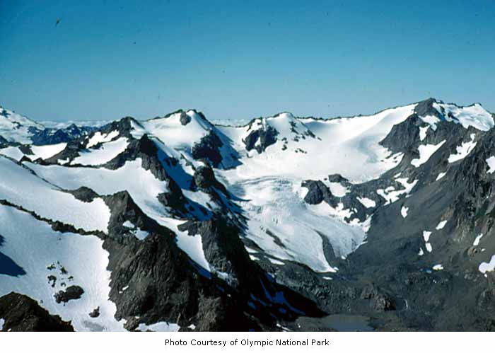 Mont Carrie (droite), pic Ruth (gauche) et glacier Fairchild. | |||
| Géographie | |||
|---|---|---|---|
| Altitude | 2 132 m[1],[2] | ||
| Massif | Montagnes Olympiques | ||
| Coordonnées | 47° 53′ 39″ nord, 123° 38′ 57″ ouest[1],[2] | ||
| Administration | |||
| Pays | |||
| État | Washington | ||
| Comté | Clallam | ||
| Géolocalisation sur la carte : États-Unis
Géolocalisation sur la carte : Washington
| |||
| modifier |
|||


Géographie
Le mont Carrie culmine à 2 132 m[2] à l'intérieur du parc national Olympique. Il s'agit d'un des plus importants sommets du parc après le mont Anderson (2 231 m), le mont Deception (2 374 m) et le mont Olympe (2 432 m)[3]. La montagne accueille le glacier Carrie[4].
Annexes
Bibliographie
- (en) George Wuerthner et Douglas W. Moore, Olympic : A Visitor's Companion, Stackpole Books, , 278 p. (ISBN 978-0-8117-2869-0, lire en ligne)
Liens externes
- Ressources relatives à la géographie :
Notes et références
- Visualisation sur l'USGS.
- (en) Mount Carrie, Washington, peakbagger.com.
- (en) « Carte du parc national Olympique », National Park Service, (consulté le )
- George Wuerthner, Douglas W. Moore 2003, p. 49
 Portail de la montagne
  Portail de l’État de Washington
На других языках
[en] Mount Carrie
Mount Carrie is a 6,995-foot (2,132-metre) mountain summit located within Olympic National Park in Clallam County of Washington state.[4] Mt. Carrie is the highest point in the Bailey Range which is a subrange of the Olympic Mountains. With a good eye and clear weather, the mountain can be seen from the visitor center at Hurricane Ridge. Its nearest higher peak is Mount Mathias (7,156 ft) which is an outlier of Mount Olympus, 6.24 mi (10.04 km) to the south.[1] Due to heavy winter snowfalls, Mount Carrie supports the Carrie Glacier in its northeast cirque, and Fairchild Glacier on the east slope. Precipitation runoff from the mountain drains into tributaries of the Elwha River and Hoh River. There is a scrambling route via the High Divide Trail and Cat Walk.[3]- [fr] Mont Carrie
Текст в блоке "Читать" взят с сайта "Википедия" и доступен по лицензии Creative Commons Attribution-ShareAlike; в отдельных случаях могут действовать дополнительные условия.
Другой контент может иметь иную лицензию. Перед использованием материалов сайта WikiSort.org внимательно изучите правила лицензирования конкретных элементов наполнения сайта.
Другой контент может иметь иную лицензию. Перед использованием материалов сайта WikiSort.org внимательно изучите правила лицензирования конкретных элементов наполнения сайта.
2019-2026
WikiSort.org - проект по пересортировке и дополнению контента Википедии
WikiSort.org - проект по пересортировке и дополнению контента Википедии