geo.wikisort.org - Montagne
Le mont Buruntza est une montagne de 441 m d'altitude située dans la communauté autonome du Pays basque, à 12 km au sud de Saint-Sébastien.
Cet article est une ébauche concernant la montagne et le Pays basque.
Vous pouvez partager vos connaissances en l’améliorant (comment ?) selon les recommandations des projets correspondants.
| Mont Buruntza | ||||
 Vue de la face nord-ouest. | ||||
| Géographie | ||||
|---|---|---|---|---|
| Altitude | 441 m[1] | |||
| Massif | Montagnes basques | |||
| Coordonnées | 43° 14′ 20″ nord, 2° 00′ 53″ ouest[1] | |||
| Administration | ||||
| Pays | ||||
| Communauté autonome | Pays basque | |||
| Province | Guipuscoa | |||
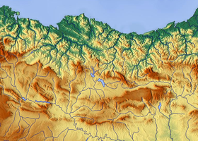
| Géolocalisation sur la carte : Espagne
Géolocalisation sur la carte : Pays basque
Géolocalisation sur la carte : Montagnes basques
| ||||
| modifier |
||||


Notes et références
- Mont Buruntza sur l'IGN espagnol.
 Portail de la montagne
  Portail du Pays basque
  Portail de la Communauté autonome du Pays basque
На других языках
[en] Buruntza
Buruntza (441 m) is a minor mountain in the Basque Country (Spain) 12 km south of San Sebastian. Several towns lie at its foot, namely Andoain (S), Lasarte-Oria (N) and Urnieta (E). The mountain stretches out in a north-east to south-west disposition, starting at the pass of Azkorte (hermitage) on to a quarry at the southern end, by the neighbourhood Buruntza in Andoain. The mountain rises opposite to Adarra (E) and stands in turn to the east of the mountain Andatza (562 m). There is a big cross fixed at the summit.[es] Burunza
El monte Burunza (Buruntza en vascuence) es una pequeña elevación de unos 441 msnm, situada 12 km al sur de San Sebastián, en el País Vasco (España).- [fr] Mont Buruntza
Текст в блоке "Читать" взят с сайта "Википедия" и доступен по лицензии Creative Commons Attribution-ShareAlike; в отдельных случаях могут действовать дополнительные условия.
Другой контент может иметь иную лицензию. Перед использованием материалов сайта WikiSort.org внимательно изучите правила лицензирования конкретных элементов наполнения сайта.
Другой контент может иметь иную лицензию. Перед использованием материалов сайта WikiSort.org внимательно изучите правила лицензирования конкретных элементов наполнения сайта.
2019-2026
WikiSort.org - проект по пересортировке и дополнению контента Википедии
WikiSort.org - проект по пересортировке и дополнению контента Википедии