geo.wikisort.org - Montagne
Le mont Ascutney (957 m) est le principal sommet du comté de Windsor, dans le Vermont, au nord-est des États-Unis.
| Mont Ascutney | |||
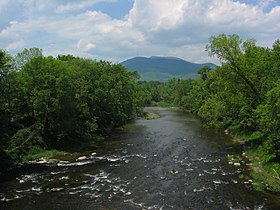
 Le mont Ascutney vu de Claremont au New Hampshire | |||
| Géographie | |||
|---|---|---|---|
| Altitude | 957 m[1] | ||
| Massif | Montagnes Vertes (Appalaches) | ||
| Coordonnées | 43° 26′ 37″ nord, 72° 27′ 17″ ouest[1] | ||
| Administration | |||
| Pays | |||
| État | Vermont | ||
| Comté | Windsor | ||
| Géolocalisation sur la carte : États-Unis
Géolocalisation sur la carte : Vermont
| |||
| modifier |
|||
Situation et description
Le mont Ascutney est situé au sud-est du comté de Windsor, dans la vallée du Connecticut. La station de ski Ascutney se trouve à Brownsville.
Notes et références
- Visualisation sur l'USGS.
Liens externes
- Ressources relatives à la géographie :
- (en) Station de ski d'Ascutney
- Portail de la montagne
- Portail du Vermont
На других языках
[en] Mount Ascutney
Mount Ascutney is a mountain in the U.S. state of Vermont. At 3,144 feet (958 m), it is the second-highest peak in Windsor County. (The highest peak in the county is Gillespie Peak in the Joseph Battell Wilderness.) Mount Ascutney is a monadnock that rises abruptly from the surrounding lowlands. For example, the Windsor Trail is 2.7 miles (4.3 km) to the summit with 2,514 feet (766 m) of elevation gain and an overall 18% grade. Particularly noteworthy are the mountain's granite outcrops, one of which, near the summit, serves as a launching point for hang-gliders.- [fr] Mont Ascutney
Текст в блоке "Читать" взят с сайта "Википедия" и доступен по лицензии Creative Commons Attribution-ShareAlike; в отдельных случаях могут действовать дополнительные условия.
Другой контент может иметь иную лицензию. Перед использованием материалов сайта WikiSort.org внимательно изучите правила лицензирования конкретных элементов наполнения сайта.
Другой контент может иметь иную лицензию. Перед использованием материалов сайта WikiSort.org внимательно изучите правила лицензирования конкретных элементов наполнения сайта.
2019-2025
WikiSort.org - проект по пересортировке и дополнению контента Википедии
WikiSort.org - проект по пересортировке и дополнению контента Википедии

