geo.wikisort.org - Montagne
Le Loenpo Gang, ou Lönpo Gang , est un sommet à la frontière entre le Népal et la Chine se situant en Himalaya. Il culmine à 6 979 mètres d'altitude. Il se situe à quelques kilomètres du Dorje Lhakpa.
Cet article est une ébauche concernant la montagne, le Népal et la Chine.
Vous pouvez partager vos connaissances en l’améliorant (comment ?) selon les recommandations des projets correspondants.
| Loenpo Gang | ||||
 Vue du Loenpo Gang depuis Dulalthok. | ||||
| Géographie | ||||
|---|---|---|---|---|
| Altitude | 6 979 m | |||
| Massif | Himalaya | |||
| Coordonnées | 28° 11′ 45″ nord, 85° 47′ 58″ est | |||
| Administration | ||||
| Pays | ||||
| Province Région autonome |
No 3 Tibet |
|||
| Districts Ville-préfecture |
Rasuwa, Sindhulpalchok Shigatsé |
|||
| Ascension | ||||
| Première | 1962 | |||
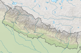
| Géolocalisation sur la carte : Région autonome du Tibet
Géolocalisation sur la carte : Chine
Géolocalisation sur la carte : Népal
| ||||
| modifier |
||||


Notes et références
 Portail de la montagne
  Portail du Népal
  Portail du Tibet
На других языках
[de] Loenpo Gang
Der Berg Loenpo Gang oder Lönpo Gang (wird auch als Big White Peak für „großer weißer Gipfel“ bezeichnet) befindet sich in einer Bergkette im Zentral-Himalaya südöstlich des Flusstals des Langtang Khola an der Grenze zwischen der nepalesischen Verwaltungszone Bagmati und dem autonomen Gebiet Tibet (China).[en] Loenpo Gang
Loenpo Gang (also known as Lönpo Gang) is a mountain peak in the Himalayas on the border of Nepal and the Tibet Autonomous Region of People's Republic of China.[1]- [fr] Loenpo Gang
Текст в блоке "Читать" взят с сайта "Википедия" и доступен по лицензии Creative Commons Attribution-ShareAlike; в отдельных случаях могут действовать дополнительные условия.
Другой контент может иметь иную лицензию. Перед использованием материалов сайта WikiSort.org внимательно изучите правила лицензирования конкретных элементов наполнения сайта.
Другой контент может иметь иную лицензию. Перед использованием материалов сайта WikiSort.org внимательно изучите правила лицензирования конкретных элементов наполнения сайта.
2019-2026
WikiSort.org - проект по пересортировке и дополнению контента Википедии
WikiSort.org - проект по пересортировке и дополнению контента Википедии