geo.wikisort.org - Montagne
L'Im hintern Eis est une montagne qui s’élève à 3 269 ou 3 270 m d’altitude dans les Alpes de l'Ötztal à la frontière entre l'Autriche et l'Italie.
Cet article est une ébauche concernant la montagne, l’Autriche et le Trentin-Haut-Adige.
Vous pouvez partager vos connaissances en l’améliorant (comment ?) selon les recommandations des projets correspondants.
| Im hintern Eis | |||||
 Vue de l'Im hintern Eis (au fond sur la droite). | |||||
| Géographie | |||||
|---|---|---|---|---|---|
| Altitude | 3 269 ou 3 270 m[1],[2] | ||||
| Massif | Alpes de l'Ötztal (Alpes) | ||||
| Coordonnées | 46° 47′ 36″ nord, 10° 46′ 54″ est[2],[1] | ||||
| Administration | |||||
| Pays | |||||
| Land Région à statut spécial |
Tyrol Trentin-Haut-Adige |
||||
| District Province autonome |
Imst Bolzano |
||||
| Ascension | |||||
| Voie la plus facile | versant sud-est | ||||
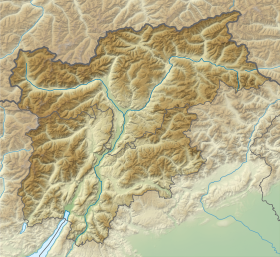
| Géolocalisation sur la carte : Autriche
Géolocalisation sur la carte : Italie
Géolocalisation sur la carte : Tyrol
Géolocalisation sur la carte : Trentin-Haut-Adige
| |||||
| modifier |
|||||


Notes et références
- (de) Cet article est partiellement ou en totalité issu de l’article de Wikipédia en allemand intitulé « Im hintern Eis » (voir la liste des auteurs).
- Visualisation sur le géoportail italien.
- Visualisation sur BEV.
 Portail de la montagne
  Portail des Alpes
  Portail de l'Autriche
  Portail du Trentin-Haut-Adige
На других языках
[de] Im Hintern Eis
Im Hintern Eis (italienisch Punta della Vedretta) ist ein 3270 m s.l.m. hoher, nicht vergletscherter Gipfel im Schnalskamm der Ötztaler Alpen auf der Grenze zwischen Österreich und Italien. Der Berg bildet gemeinsam mit der Inneren Quellspitze (3514 m ü. A.), dem Teufelsegg (3227 m ü. A.) und dem Egg (3219 m ü. A.) die südliche Umrandung des Hintereisferners.[en] Im Hinteren Eis
Im Hinteren Eis is a mountain in the Ötztal Alps on the border between Tyrol, Austria, and South Tyrol, Italy.- [fr] Im hintern Eis
Текст в блоке "Читать" взят с сайта "Википедия" и доступен по лицензии Creative Commons Attribution-ShareAlike; в отдельных случаях могут действовать дополнительные условия.
Другой контент может иметь иную лицензию. Перед использованием материалов сайта WikiSort.org внимательно изучите правила лицензирования конкретных элементов наполнения сайта.
Другой контент может иметь иную лицензию. Перед использованием материалов сайта WikiSort.org внимательно изучите правила лицензирования конкретных элементов наполнения сайта.
2019-2026
WikiSort.org - проект по пересортировке и дополнению контента Википедии
WikiSort.org - проект по пересортировке и дополнению контента Википедии