geo.wikisort.org - Montagne
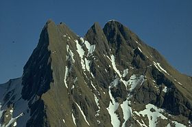
La Höfats est une montagne qui s'élève à 2 258 m d'altitude dans les Alpes d'Allgäu, en Bavière.
| Höfats | |
 Vue de la Höfats depuis le Kegelkopf vers le sud-ouest. | |
| Géographie | |
|---|---|
| Altitude | 2 258 m[1] |
| Massif | Alpes d'Allgäu (Alpes) |
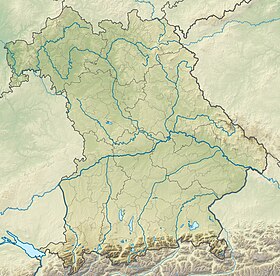
| Coordonnées | 47° 22′ 02″ nord, 10° 20′ 58″ est[1] |
| Administration | |
| Pays | |
| Land | Bavière |
| District | Souabe |
| Ascension | |
| Première | 1848 par O. Sendtner |
| modifier |
|
Notes et références
- (de) Cet article est partiellement ou en totalité issu de l’article de Wikipédia en allemand intitulé « Höfats » (voir la liste des auteurs).
- Höfats sur Bayerische Vermessungsverwaltung.
- Portail de la montagne
- Portail des Alpes
- Portail de la Bavière
На других языках
[de] Höfats
Die Höfats ist ein 2259 m hoher Berg in den Allgäuer Alpen. Nahe Oberstdorf gelegen, trennt sie, zusammen mit dem Rauheck und weiteren kleineren Gipfeln, das Oytal vom Dietersbachtal. Sie ist als der markanteste Allgäuer Grasberg mit sehr steilen Flanken einzigartig in den Ostalpen.[en] Höfats
The Höfats is a 2,259 m high mountain in the Allgäu Alps. Located near Oberstdorf, it separates the Oy and the Dietersbach valleys, along with the Rauheck and other lower summits. With its very steep faces it is the most striking of the Allgau "grass mountains" (Grasberge) and is unique in the Eastern Alps. It may be compared to the mountains of the Lofoten.- [fr] Höfats
Текст в блоке "Читать" взят с сайта "Википедия" и доступен по лицензии Creative Commons Attribution-ShareAlike; в отдельных случаях могут действовать дополнительные условия.
Другой контент может иметь иную лицензию. Перед использованием материалов сайта WikiSort.org внимательно изучите правила лицензирования конкретных элементов наполнения сайта.
Другой контент может иметь иную лицензию. Перед использованием материалов сайта WikiSort.org внимательно изучите правила лицензирования конкретных элементов наполнения сайта.
2019-2025
WikiSort.org - проект по пересортировке и дополнению контента Википедии
WikiSort.org - проект по пересортировке и дополнению контента Википедии

