geo.wikisort.org - Montagne
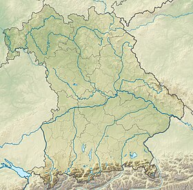
Le Hochvogel est un sommet des Alpes, à 2 592 m, dans les Alpes d'Allgäu, et en particulier dans le chaînon principal, entre l'Autriche (Land du Tyrol) et l'Allemagne (Bavière).
| Hochvogel | |
 Le Hochvogel | |
| Géographie | |
|---|---|
| Altitude | 2 592 m[1],[2] |
| Massif | Alpes d'Allgäu (Alpes) |
| Coordonnées | 47° 22′ 50″ nord, 10° 26′ 12″ est[1],[2] |
| Administration | |
| Pays | |
| Land allemand Land autrichien |
Bavière Tyrol |
| District allemand District autrichien |
Souabe Reutte |
| Ascension | |
| Première | 1832 par Trobitius |
| Voie la plus facile | Par la cabane Prinz-Luitpold |
| modifier |
|
Notes et références
- Hochvogel sur Bayerische Vermessungsverwaltung.
- Visualisation sur BEV.
- Portail de la montagne
- Portail des Alpes
- Portail de l'Autriche
- Portail de la Bavière
На других языках
[de] Hochvogel
Der Hochvogel ist ein 2592 m hoher Berg in den Allgäuer Alpen. Über seinen Gipfel verläuft die Grenze zwischen Deutschland und Österreich. Obwohl nur der dreizehnthöchste Gipfel der Allgäuer Alpen, dominiert der Hochvogel weite Teile der Allgäuer Alpen und der unmittelbar benachbarten Gebirgsgruppen. Dies liegt daran, dass die meisten der höheren Gipfel sich im zentralen und westlichen Teil der Allgäuer Alpen konzentrieren. Der Hochvogel steht frei im Ostteil der Gebirgsgruppe, die nächstgelegenen Gipfel sind 200 bis 300 Meter niedriger.[en] Hochvogel
The Hochvogel is a 2,592-metre-high (8,504 ft) mountain in the Allgäu Alps. The national border between Germany and Austria runs over the summit. Although only the thirteenth highest summit in the Allgäu Alps, the Hochvogel dominates other parts of Allgäu Alps and the other ranges in the immediate neighbourhood. This is due to the fact that the majority of the higher peaks are concentrated in the central and western part of the Allgäu Alps. The Hochvogel stands on its own in the eastern part of the mountain group; the nearest neighbouring summits are 200 to 300 metres lower. Experienced climbers can ascend the summit on two marked routes.- [fr] Hochvogel
Текст в блоке "Читать" взят с сайта "Википедия" и доступен по лицензии Creative Commons Attribution-ShareAlike; в отдельных случаях могут действовать дополнительные условия.
Другой контент может иметь иную лицензию. Перед использованием материалов сайта WikiSort.org внимательно изучите правила лицензирования конкретных элементов наполнения сайта.
Другой контент может иметь иную лицензию. Перед использованием материалов сайта WikiSort.org внимательно изучите правила лицензирования конкретных элементов наполнения сайта.
2019-2025
WikiSort.org - проект по пересортировке и дополнению контента Википедии
WikiSort.org - проект по пересортировке и дополнению контента Википедии


