geo.wikisort.org - Montagne
Le Grünhorn est un sommet culminant à 4 044 m d'altitude dans les Alpes bernoises. Il est également appelé Gross Grünhorn ou Grosses Grünhorn pour le distinguer du Kleines Grünhorn, situé quelques centaines de mètres au nord-ouest[2].
Pour les articles homonymes, voir Grünhorn (homonymie).
| Grünhorn | |
 De gauche à droite : Gross Fiescherhorn, Hinter Fiescherhorn, Grünhorn (milieu), Finsteraarhorn et Gross Wannenhorn | |
| Géographie | |
|---|---|
| Altitude | 4 044 m[1] |
| Massif | Alpes bernoises (Alpes) |
| Coordonnées | 46° 31′ 55″ nord, 8° 04′ 39″ est[1] |
| Administration | |
| Pays | |
| Canton | Valais |
| District | Conches |
| Ascension | |
| Première | par Edmund von Fellenberg avec Peter Michel, Peter Egger et Peter Inäbnit |
| Voie la plus facile | Depuis le refuge Konkordia (arête sud-ouest ; PD+) |
| modifier |
|
Situation

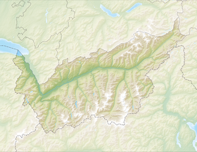
Il se situe en Suisse dans le canton du Valais. Son accès est possible par les refuges et bivouacs suivants :
- Konkordiahütte 2 850 m ;
- Hollandiahütte 3 240 m ;
- Mönchsjochhütte 3 657 m ;
- Finsteraarhornhütte 3 048 m.
Alpinisme
La première ascension a été réalisée le par Edmund von Fellenberg, avec les guides Peter Michel, Peter Egger et Peter Inäbnit. La seconde par William Auguste Coolidge avec les guides Christian et Rudolf Almer.
Paul Etter réalise la première ascension hivernale du pilier est en 1973.
Le , l'alpiniste Erhard Loretan y fait une chute mortelle de 200 mètres en compagnie d'une cliente qui est grièvement blessée.
Notes et références
- Visualisation sur Swisstopo.
- (de) « Gross / Grosses Grünhorn 4044 m », sur www.sac-cas.ch (consulté le ).
Annexes
Voir aussi
- Classement des sommets des Alpes de plus de 4000 mètres
- Portail de la géographie de la Suisse
- Portail de la montagne
- Portail des Alpes
- Portail du Valais
На других языках
[de] Gross Grünhorn
Das Gross Grünhorn (auch Grosses Grünhorn genannt) ist mit einer Höhe von 4043,5 m ü. M. ein Viertausender in den Berner Alpen, der aber im Schweizer Kanton Wallis liegt. Der Gipfelaufbau besteht aus Amphibolitgestein, das grüne Hornblende (Amphibol) enthält, wovon sich der Name des Berges ableitet.[en] Grünhorn
The Grünhorn (or Gross Grünhorn) (4,044 m) is a mountain in the Bernese Alps range of the Swiss Alps. It is located on the ridge between the two largest glaciers of the Alps: the Aletsch Glacier to the west and the Fiescher Glacier to the east. To the south lies the Gross Wannenhorn and, to the north, the Gross Fiescherhorn.[es] Grünhorn
El Grünhorn (literalmente Cuerno verde) es una montaña en el macizo de los Alpes berneses en Suiza, tiene una altura de más de 4.000 msnm.- [fr] Grünhorn
[it] Grünhorn
Il Grünhorn (4.043 m s.l.m. - detto anche Gross Grünhorn) è una montagna delle Alpi Bernesi. Si trova nel cantone svizzero del Vallese.[ru] Грос-Грюнхорн
Грос-Грю́нхорн (нем. Gross Grünhorn) или Грюнхо́рн (нем. Grünhorn) — гора в Бернских Альпах, кантон Вале, Швейцария. Её высота — 4 044 метра над уровнем моря.Другой контент может иметь иную лицензию. Перед использованием материалов сайта WikiSort.org внимательно изучите правила лицензирования конкретных элементов наполнения сайта.
WikiSort.org - проект по пересортировке и дополнению контента Википедии

