geo.wikisort.org - Montagne
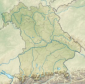
Le Grünten est un sommet des Alpes, à 1 738 m d'altitude, dans les Alpes d'Allgäu, et en particulier le point culminant des Préalpes d'Allgäu à l'est de l'Iller, en Allemagne (Bavière).

| Grünten | |
 Le Grünten depuis Sonthofen (sud-ouest) | |
| Géographie | |
|---|---|
| Altitude | 1 738 m, Übelhorn[1] |
| Massif | Alpes d'Allgäu (Alpes) |
| Coordonnées | 47° 33′ 18″ nord, 10° 19′ 12″ est[1] |
| Administration | |
| Pays | |
| Land | Bavière |
| District | Souabe |
| modifier |
|
Notes et références
- Grünten sur Bayerische Vermessungsverwaltung.
Liens externes
- Portail de la montagne
- Portail des sports d’hiver
- Portail des Alpes
- Portail de la Bavière
На других языках
[de] Grünten
Der Grünten ist ein 1737,9 m ü. NHN[1] hoher Bergrücken der Allgäuer Alpen. Er liegt bei Burgberg im Allgäu im bayerischen Landkreis Oberallgäu.[en] Grünten
Grünten (also, Watcher of the Allgäu) is a mountain of Bavaria, Germany. On the summit is a Gebirgsjäger monument, dedicated to German mountain troopers killed in action.[when?] Not far from there, on the lower crest, is a radio tower of the Bavarian Broadcasting Corporation. The cable car connecting the village of Rettenberg and the radio tower was closed to the public in 2014 and is now only used to transport material or members of staff up to the radio tower.[1]- [fr] Grünten
Текст в блоке "Читать" взят с сайта "Википедия" и доступен по лицензии Creative Commons Attribution-ShareAlike; в отдельных случаях могут действовать дополнительные условия.
Другой контент может иметь иную лицензию. Перед использованием материалов сайта WikiSort.org внимательно изучите правила лицензирования конкретных элементов наполнения сайта.
Другой контент может иметь иную лицензию. Перед использованием материалов сайта WikiSort.org внимательно изучите правила лицензирования конкретных элементов наполнения сайта.
2019-2025
WikiSort.org - проект по пересортировке и дополнению контента Википедии
WikiSort.org - проект по пересортировке и дополнению контента Википедии

