geo.wikisort.org - Montagne
Le Gada Ale est un volcan d'Éthiopie.
| Gada Ale | ||
 |
||
| Géographie | ||
|---|---|---|
| Altitude | 287 m | |
| Massif | Vallée du Grand Rift | |
| Coordonnées | 13° 58′ 28″ nord, 40° 24′ 36″ est | |
| Administration | ||
| Pays | ||
| Région | Afar | |
| Zone | Zone 2 | |
| Géologie | ||
| Âge | Holocène | |
| Type | Volcan de rift | |
| Morphologie | Stratovolcan | |
| Activité | Inconnue | |
| Dernière éruption | Inconnue | |
| Code GVP | 221050 | |
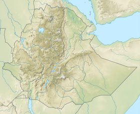
| Géolocalisation sur la carte : Éthiopie
| ||
| modifier |
||
Voir aussi
Articles connexes
Liens externes
- (en) Gada Ale, Global Volcanism Program
- Portail de l’Éthiopie
- Portail de la montagne
- Portail du volcanisme
На других языках
[de] Gada Ale
Gada Ale (auch Kebrit Ale) ist ein 287 Meter hoher Basaltvulkan in Äthiopien. Er erhebt sich aus der Koba-Senke (115 m unter dem Meeresspiegel), im Afar-Dreieck, in der Region Afar.[en] Gada Ale
Gada Ale is a stratovolcano located in the Afar Region, Ethiopia. It is the most prominent volcano at the northern end of the Erta Ale Range.- [fr] Gada Ale
[it] Gada Ale
Il Gada Ale, detto anche Kebrit Ale, è lo stratovulcano più settentrionale della catena dell'Erta Ale in Dancalia. Con i suoi 287 metri di altezza è anche il più basso dei vulcani principali. Non si conosce la data dell'ultima eruzione. Attualmente è spento.[ru] Гада-Але
Гада-Але — стратовулкан, расположенный во второй административной зоне, в регионе Афар, Эфиопия. Его высота достигает 287 м. Другое название вулкана Кебрит-Але.Текст в блоке "Читать" взят с сайта "Википедия" и доступен по лицензии Creative Commons Attribution-ShareAlike; в отдельных случаях могут действовать дополнительные условия.
Другой контент может иметь иную лицензию. Перед использованием материалов сайта WikiSort.org внимательно изучите правила лицензирования конкретных элементов наполнения сайта.
Другой контент может иметь иную лицензию. Перед использованием материалов сайта WikiSort.org внимательно изучите правила лицензирования конкретных элементов наполнения сайта.
2019-2025
WikiSort.org - проект по пересортировке и дополнению контента Википедии
WikiSort.org - проект по пересортировке и дополнению контента Википедии
