geo.wikisort.org - Montagne
La Dreiländerspitze (littéralement « pointe des trois pays ») est une montagne qui s’élève à 3 196 ou 3 197 m d’altitude à la frontière entre l'Autriche et la Suisse.
| Dreiländerspitze | |
 Vue depuis l'ouest avec le glacier de Vermunt au premier plan. | |
| Géographie | |
|---|---|
| Altitude | 3 196 ou 3 197 m[1],[2] |
| Massif | Silvretta (Alpes) |
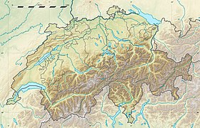
| Coordonnées | 46° 51′ 04″ nord, 10° 08′ 42″ est[1],[2] |
| Administration | |
| Pays | |
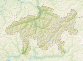
| Länder Canton |
Tyrol Vorarlberg Grisons |
| Districts Région |
Landeck Bludenz Engiadina Bassa/Val Müstair |
| Ascension | |
| Première | 14 juillet 1870 par Th. Petersen, O. Morell et D. Barbeuda |
| Voie la plus facile | depuis la Wiesbadener Hütte à l'ouest |
| modifier |
|
Notes et références
- (de) Cet article est partiellement ou en totalité issu de l’article de Wikipédia en allemand intitulé « Dreiländerspitze » (voir la liste des auteurs).
- Visualisation sur Swisstopo.
- Visualisation sur BEV.
- Portail de la montagne
- Portail des Alpes
- Portail de l'Autriche
- Portail du canton des Grisons
- Portail de la géographie de la Suisse
На других языках
[de] Dreiländerspitze
Die Dreiländerspitze ist mit 3197 m ü. A. der höchste Berg der Dreiländerspitzgruppe in der Silvretta, einem Gebirge der zentralen Ostalpen.[en] Dreiländerspitze
The Dreiländerspitze is one of the higher mountains in the Silvretta range in the eastern Alps, at 3,197 metres. The borders of Graubünden (Switzerland), Vorarlberg (Austria) and Tyrol (Austria) meet at the peak. Its name (Dreiländerspitze means peak of three countries) refers to a meeting point between the territories of three ancient tribes (Rhaeto-Romance or Romansch, Bavarii and Alamanni) and their languages. It is also on the watershed between the Rhine and Danube. It is a favourite viewpoint, due to its position and accessibility. Its first documented ascent was by the German alpinist Theodor Petersen, accompanied by two locals, on 14 July 1870, although it appeared to have been previously climbed by surveyors in the 1850s. The nearest settlements are Galtür, 14 km to the north, and Guarda, 9 km to the south.- [fr] Dreiländerspitze
[it] Dreiländerspitze
Il Dreiländerspitze (3 197 m s.l.m.) è una montagna del Gruppo del Silvretta nelle Alpi Retiche occidentali che si trova al confine tra la Svizzera (Canton Grigioni) e l'Austria (Vorarlberg e Tirolo).Текст в блоке "Читать" взят с сайта "Википедия" и доступен по лицензии Creative Commons Attribution-ShareAlike; в отдельных случаях могут действовать дополнительные условия.
Другой контент может иметь иную лицензию. Перед использованием материалов сайта WikiSort.org внимательно изучите правила лицензирования конкретных элементов наполнения сайта.
Другой контент может иметь иную лицензию. Перед использованием материалов сайта WikiSort.org внимательно изучите правила лицензирования конкретных элементов наполнения сайта.
2019-2025
WikiSort.org - проект по пересортировке и дополнению контента Википедии
WikiSort.org - проект по пересортировке и дополнению контента Википедии


