geo.wikisort.org - Montagne
Le Doi Chiang Dao (thaï : ดอยเชียงดาว) est une montagne de Thaïlande, proche de la frontière birmane, culminant à 2 175 m d'altitude.
Cet article est une ébauche concernant la montagne et la Thaïlande.
Vous pouvez partager vos connaissances en l’améliorant (comment ?) selon les recommandations des projets correspondants.
| Doi Chiang Dao | ||
 Doi Chiang Dao | ||
| Géographie | ||
|---|---|---|
| Altitude | 2 175 m | |
| Massif | Monts Daen Lao (plateau Shan) | |
| Coordonnées | 19° 23′ 59″ nord, 98° 52′ 36″ est | |
| Administration | ||
| Pays | ||
| Province | Chiang Mai | |
| Amphoe | Chiang Dao | |
| Géologie | ||
| Roches | Calcaire | |
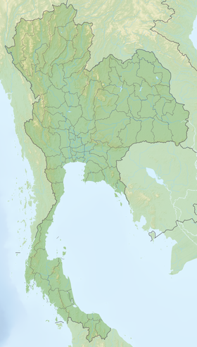
| Géolocalisation sur la carte : Thaïlande
| ||
| modifier |
||
Réserve de biosphère
Le site a été reconnu réserve de biosphère par l'Unesco en 2021[1].
Le palmier endémique Trachycarpus oreophilus ne pousse que sur cette montagne[2].
Notes et références
- « Biodiversité : l’UNESCO désigne 20 nouvelles réserves de biosphère », sur ONU Info, (consulté le )
- (en) « Trachycarpus oreophilus Gibbons & Spanner | Plants of the World Online | Kew Science », sur Plants of the World Online (consulté le )
 Portail de la montagne
  Portail de la Thaïlande
На других языках
[en] Doi Chiang Dao
Doi Chiang Dao (Thai: ดอยเชียงดาว, pronounced [dɔ̄ːj t͡ɕʰīa̯ŋ dāːw]), also known as Doi Luang Chiang Dao (ดอยหลวงเชียงดาว, pronounced [dɔ̄ːj lǔa̯ŋ t͡ɕʰīa̯ŋ dāːw]), is a 2,175 metres (7,136 ft) high mountain in Chiang Dao District of Chiang Mai Province, Thailand. It is one of the highest peaks of the Daen Lao Range on the Thai side of the border.- [fr] Doi Chiang Dao
Текст в блоке "Читать" взят с сайта "Википедия" и доступен по лицензии Creative Commons Attribution-ShareAlike; в отдельных случаях могут действовать дополнительные условия.
Другой контент может иметь иную лицензию. Перед использованием материалов сайта WikiSort.org внимательно изучите правила лицензирования конкретных элементов наполнения сайта.
Другой контент может иметь иную лицензию. Перед использованием материалов сайта WikiSort.org внимательно изучите правила лицензирования конкретных элементов наполнения сайта.
2019-2026
WikiSort.org - проект по пересортировке и дополнению контента Википедии
WikiSort.org - проект по пересортировке и дополнению контента Википедии