geo.wikisort.org - Montagne
Le Devils Thumb (thumb signifie « pouce » et devil est le diable en français) est une montagne située à la limite entre l'Alaska et la Colombie-Britannique, dans les chaînons Boundary, au sein de la calotte glaciaire Stikine, près de Petersburg.
Pour les articles homonymes, voir Thumb (homonymie).
Cet article est une ébauche concernant la montagne.
Vous pouvez partager vos connaissances en l’améliorant (comment ?) selon les recommandations des projets correspondants.
| Devils Thumb | |||||
 Devils Thumb | |||||
| Géographie | |||||
|---|---|---|---|---|---|
| Altitude | 2 767 m[1] | ||||
| Massif | Chaînons Boundary (chaîne Côtière) |
||||
| Coordonnées | 57° 05′ 29″ nord, 132° 22′ 00″ ouest[1] | ||||
| Administration | |||||
| Pays | |||||
| État Province |
Alaska Colombie-Britannique |
||||
| Région de recensement District régional |
Wrangell-Petersburg Kitimat-Stikine |
||||
| Ascension | |||||
| Première | 1946, par Fred Beckey, Clifford Schmidtke, et Bob Craig | ||||
| Géologie | |||||
| Type | Pic pyramidal | ||||
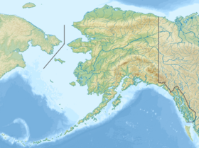
| Géolocalisation sur la carte : Colombie-Britannique
Géolocalisation sur la carte : Alaska
Géolocalisation sur la carte : Canada
Géolocalisation sur la carte : États-Unis
| |||||
| modifier |
|||||


Alpinisme
- 1937 - Première tentative par Fritz Wiessner
- 1946 - Première ascension par Fred Beckey, Clifford Schmidtke, et Bob Craig.
- 2010 - Première traversée intégrale ouest-est : Diablo Traverse, par Colin Healey et Mikey Schaefer[2].
Jon Krakauer en fait une description dans ses livres Rêves de montagnes et Voyage au bout de la solitude (Into the Wild).
Notes et références
- Visualisation sur l'USGS.
- Montagnes Magazine, no 362, janvier 2011, p. 51
Voir aussi
Bibliographie
- Michael Wood, Colby Coombs, Alaska: A Climbing Guide, The Mountaineers, 2001
- Jonathan Krakauer, Eiger Dreams, Anchor, 1997
- American Alpine Journal, 2004, 2005[réf. incomplète]
Liens externes
- Ressources relatives à la géographie :
 Portail de la montagne
  Portail de l’Alaska
  Portail de la Colombie-Britannique
На других языках
[de] Devils Thumb (Coast Mountains)
Devils Thumb (engl. für „Teufelsdaumen“) ist ein 2777 m hoher Berg an der Grenze zwischen Alaska (USA) und British Columbia (Kanada).[en] Devils Thumb
Devils Thumb, or Taalkhunaxhkʼu Shaa in Tlingit, is a mountain in the Stikine Icecap region of the Alaska–British Columbia border, near Petersburg. It is named for its projected thumb-like appearance. Its name in the Tlingit language means "the mountain that never flooded" and is said to have been a refuge for people during Aangalakhu ("the Great Flood"). It is one of the peaks that marks the border between the United States and Canada, and is also listed on maps as Boundary Peak 71.- [fr] Devils Thumb
[ru] Девилс-Тамб
Девилс-Тамб (англ. Devils Thumb, тл. Taalkhunaxhkʼu Shaa, рус. Большой палец дьявола) — гора на границе Канады (Британская Колумбия, район Кассиар-Ленд[en])[2] и США (Аляска, боро Питерсберг). На некоторых картах эта гора также обозначена как Пограничный пик 71 (англ. Boundary Peak 71)[3].Текст в блоке "Читать" взят с сайта "Википедия" и доступен по лицензии Creative Commons Attribution-ShareAlike; в отдельных случаях могут действовать дополнительные условия.
Другой контент может иметь иную лицензию. Перед использованием материалов сайта WikiSort.org внимательно изучите правила лицензирования конкретных элементов наполнения сайта.
Другой контент может иметь иную лицензию. Перед использованием материалов сайта WikiSort.org внимательно изучите правила лицензирования конкретных элементов наполнения сайта.
2019-2026
WikiSort.org - проект по пересортировке и дополнению контента Википедии
WikiSort.org - проект по пересортировке и дополнению контента Википедии