geo.wikisort.org - Montagne
Le Corno di Tramin (en allemand : Tagewaldhorn) est une montagne qui s’élève à 2 708 m d’altitude dans les Alpes de Sarntal, en Italie.
Cet article est une ébauche concernant la montagne et le Trentin-Haut-Adige.
Vous pouvez partager vos connaissances en l’améliorant (comment ?) selon les recommandations des projets correspondants.
| Corno di Tramin | |||
 Vue de la montagne depuis le sud-est. | |||
| Géographie | |||
|---|---|---|---|
| Altitude | 2 708 m[1] | ||
| Massif | Alpes de Sarntal (Alpes) | ||
| Coordonnées | 46° 46′ 50″ nord, 11° 29′ 49″ est[1] | ||
| Administration | |||
| Pays | |||
| Région à statut spécial | Trentin-Haut-Adige | ||
| Province autonome | Bolzano | ||
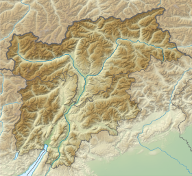
| Géolocalisation sur la carte : Trentin-Haut-Adige
Géolocalisation sur la carte : Italie
| |||
| modifier |
|||

Notes et références
- (it) Cet article est partiellement ou en totalité issu de l’article de Wikipédia en italien intitulé « Corno di Tramin » (voir la liste des auteurs).
- Visualisation sur le géoportail italien.
 Portail de la montagne
  Portail des Alpes
  Portail du Trentin-Haut-Adige
На других языках
[de] Tagewaldhorn
Das Tagewaldhorn (ital. Corno di Tramin) ist mit einer Höhe von 2708 Metern der zweithöchste Gipfel des Ostkamms der Sarntaler Alpen. Der Felsgipfel liegt nordöstlich der Flaggerscharte (2436 m s.l.m.), die das Tagewaldhorn und die vorgelagerte Hörtlanerspitze (2660 m s.l.m.) von der südlich gelegenen Jakobsspitze (2741 m s.l.m.) trennt, dem höchsten Gipfel des Sarntaler Ostkamms.[en] Tagewaldhorn
The Tagewaldhorn (Italian: Corno di Tramin; German: Tagewaldhorn) is a mountain in the Sarntal Alps in South Tyrol, Italy.- [fr] Corno di Tramin
[it] Corno di Tramin
Il Corno di Tramin (2.708 m s.l.m. - Tagewaldhorn in tedesco) è una montagna delle Alpi Retiche orientali (sottosezione Alpi Sarentine).Текст в блоке "Читать" взят с сайта "Википедия" и доступен по лицензии Creative Commons Attribution-ShareAlike; в отдельных случаях могут действовать дополнительные условия.
Другой контент может иметь иную лицензию. Перед использованием материалов сайта WikiSort.org внимательно изучите правила лицензирования конкретных элементов наполнения сайта.
Другой контент может иметь иную лицензию. Перед использованием материалов сайта WikiSort.org внимательно изучите правила лицензирования конкретных элементов наполнения сайта.
2019-2025
WikiSort.org - проект по пересортировке и дополнению контента Википедии
WikiSort.org - проект по пересортировке и дополнению контента Википедии