geo.wikisort.org - Montagne
Cheekha Dar (persan : شیخا دار, kurde : دەرێ, arabe : جبل شيخا دار) est une montagne située à la frontière entre l'Irak et l'Iran, dans les Zagros. C'est le point culminant de l'Irak.
Cet article est une ébauche concernant la montagne, l’Iran, l’Irak et le Kurdistan.
Vous pouvez partager vos connaissances en l’améliorant (comment ?) selon les recommandations des projets correspondants.
| Cheekha Dar | ||||
 Cheekha Dar | ||||
| Géographie | ||||
|---|---|---|---|---|
| Altitude | 3 611 m[1] | |||
| Massif | Zagros | |||
| Coordonnées | 36° 46′ 31″ nord, 44° 55′ 07″ est | |||
| Administration | ||||
| Pays | ||||
| Province irakienne Province iranienne |
Erbil Azerbaïdjan de l'ouest |
|||
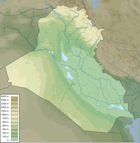
| Géolocalisation sur la carte : Irak
Géolocalisation sur la carte : Kurdistan irakien
Géolocalisation sur la carte : Iran
| ||||
| modifier |
||||


Notes et références
- (en) Field Listing - Elevation extremes, CIA World Factbook
 Portail de la montagne
  Portail de l’Irak
  Portail de l’Iran et du monde iranien
  Portail du Kurdistan
На других языках
[de] Cheekha Dar
Der Cheekha Dar ist ein Berg im Zāgros-Gebirge in der autonomen Region Kurdistan im Irak. Mit einer Höhe von 3.611 Metern ist er der höchste Punkt des Landes. Über seinen Kamm verläuft die Grenze zum Iran.[en] Cheekha Dar
Cheekha Dar, (Kurdish: Çîxî Derê / چیخی دەرێ) which means Black Tent, is the local Kurdish name for the mountain, located in Kurdistan Region of Iraq, currently thought to be the highest in Iraq. It is claimed to be 3,611 m (11,847 ft) high in the CIA World Factbook.[2] It is 6 km (3.7 mi) north of the village of Gundah Zhur and is on the border with Iran.[es] Cheekha Dar
Cheekha Dar[1][2] o Carpa Negra (en árabe: جبل شيخا دار) es el nombre local de la montaña en el Kurdistán Iraquí que actualmente se considera es el más alto en Irak. Se afirma que posee 3611 metros de altura. Se encuentra a 6 kilómetros al norte de la aldea de Gundah Zhur y está justo en la frontera con Irán.- [fr] Cheekha Dar
[it] Cheekha Dar
Il Cheekha Dar (in arabo جبل شيخا دار) è una montagna situata al confine tra l'Iran e l'Iraq, di cui costituisce la cima più elevata.[ru] Шееха-Дар
Шееха-Дар, или Боздаг[2] (араб. جبل_شيخا_دار, англ. Cheekha Dar, или в пер. с курд. — Чёрный Шатер) — вершина, расположенная на границе Ирака с Ираном, в 6 километрах к северу от деревни Gundah Zhur. Шееха-Дар считается высочайшей вершиной Ирака[3]. Шееха-Дар входит в северный отрог крупнейшей горной системы Ирана Загрос, частично простирающейся и на территорию Ирака.Текст в блоке "Читать" взят с сайта "Википедия" и доступен по лицензии Creative Commons Attribution-ShareAlike; в отдельных случаях могут действовать дополнительные условия.
Другой контент может иметь иную лицензию. Перед использованием материалов сайта WikiSort.org внимательно изучите правила лицензирования конкретных элементов наполнения сайта.
Другой контент может иметь иную лицензию. Перед использованием материалов сайта WikiSort.org внимательно изучите правила лицензирования конкретных элементов наполнения сайта.
2019-2026
WikiSort.org - проект по пересортировке и дополнению контента Википедии
WikiSort.org - проект по пересортировке и дополнению контента Википедии