geo.wikisort.org - Montagne
Le Chamar est un sommet du massif du Sringi Himal, dans l'Himalaya. Il présente deux sommets d'altitudes proches, le point culminant à 7 165 m d'altitude et 2 061 m de proéminence, et le sommet sud, à 7 165 m d'altitude et 219 m de culminance[1], distant de 800 m.
Pour l’article homonyme, voir Chamar.
Cet article est une ébauche concernant la montagne.
Vous pouvez partager vos connaissances en l’améliorant (comment ?) selon les recommandations des projets correspondants.
| Chamar | ||
 |
||
| Géographie | ||
|---|---|---|
| Altitude | 7 165 m[1] | |
| Massif | Sringi Himal (Himalaya) | |
| Coordonnées | 28° 33′ 18″ nord, 84° 56′ 39″ est[1] | |
| Administration | ||
| Pays | ||
| Province | Gandaki Pradesh | |
| District | Gorkha | |
| Ascension | ||
| Première | par M. Bishop et le sherpa Namgyl | |
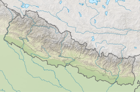
| Géolocalisation sur la carte : Népal
| ||
| modifier |
||
Le point culminant a été gravi le 6 juin 1953 par l'arête Nord-Est, par M. Bishop et le sherpa Namgyl, membres d'une expédition néo-zélandaise, trois autres membres atteignant le sommet le lendemain[2],[3]. Le sommet n'a pas été gravi depuis 1953, malgré des tentatives par une expédition japonaise en 1983 au cours de laquelle un alpiniste fut tué dans une avalanche)[4], une expédition anglo-américaine en 1994[5] et en 2000[6], toutes par l'arête Nord-Est.
Le Chamar Sud n'a jamais été gravi et fait partie des plus hauts sommets vierges du monde.
Bibliographie
- (en) Athol R. Roberts, Himalayan Holiday - An Account of the New Zealand Himalayan Expedition, Whitcombe & Tombs, 1953.
Liens externes
- Photo du Chamar
- Timelapse d'un lever de lune avec le Chamar se reflétant sur le lac Kalchhuman sur vimeo.com
Notes et références
- (en) [PDF] Eberhard Jurgalski, High Asia - All mountains and main peaks above 6650 m, 12 août 2019
- (en) [PDF] Alpine Journal, 1957, vol. 62, no 295, p. 168 [lire en ligne].
- (en) Athol R. Roberts, « The New Zealand Himalayan Expedition », New Zealand Alpine Journal, 1954, vol. 15, no 41, p. 393-399.
- (en) Michael J. Cheney et Elizabeth Hawley, « Chamar attempt and tragedy », American Alpine Journal, 1984, p.246
- (en) Elizabeth Hawley, « Chamar attempt », American Alpine Journal, 1995, p.250
- (en) Himalayan index
 Portail de la montagne
  Portail du Népal
На других языках
[de] Chamar
Der Artikel behandelt den gleichnamigen Berg im Himalaya. Zur indischen Dalit-Kaste der lederverarbeitenden Schuhmacher, Abdecker und Gerber siehe Chamar (Kaste).[en] Chamar (mountain)
Chamar is the highest peak of the Sringi (or Serang) Himal, which is a subrange of the Nepalese Himalayas. Chamar and the entire Sringi Himal lie in Central Nepal, just south of the Tibetan border, between the Shyar Khola valley on the east and the Tom Khola–Trisuli Gandaki valley on the west. Chamar is about 90 km northwest of Kathmandu, and about 25 km east of Manaslu, the nearest eight-thousander.- [fr] Chamar (sommet)
Другой контент может иметь иную лицензию. Перед использованием материалов сайта WikiSort.org внимательно изучите правила лицензирования конкретных элементов наполнения сайта.
WikiSort.org - проект по пересортировке и дополнению контента Википедии