geo.wikisort.org - Montagne
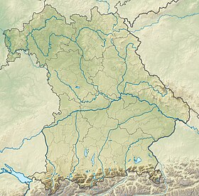
La Benediktenwand est un sommet des Alpes, à 1 800 m d'altitude, dans les Préalpes bavaroises, en Allemagne (Bavière).
| Benediktenwand | |
 Le versant nord de la Benediktenwand | |
| Géographie | |
|---|---|
| Altitude | 1 800 m[1] |
| Massif | Préalpes bavaroises (Alpes) |
| Coordonnées | 47° 39′ 11″ nord, 11° 27′ 56″ est[1] |
| Administration | |
| Pays | |
| Land | Bavière |
| District | Haute-Bavière |
| Ascension | |
| Voie la plus facile | Par le refuge Tutzinger |
| modifier |
|
Notes et références
- Benediktenwand sur Bayerische Vermessungsverwaltung.
- Portail de la montagne
- Portail des Alpes
- Portail de la Bavière
На других языках
[de] Benediktenwand
Die Benediktenwand (schon um 1300 als montem sancti Benedicti genannt)[2] ist ein 1800 m ü. NHN hoher Bergrücken in den Bayerischen Voralpen zwischen den Flüssen Loisach und Isar sowie der Jachenau im Süden und dem Kloster Benediktbeuern im Norden, von dem sie auch ihren Namen hat.[en] Benediktenwand
The Benediktenwand (formerly the Kirchstein) is a 1,800-metre-high (5,900 ft) mountain ridge in the Bavarian Prealps between the rivers Loisach and Isar and the Jachenau in the south and Benediktbeuern Abbey, from which it derives its name, in the north. Immediately below the North Face of the Benediktenwand is the Tutzinger Hut (1,327 m).- [fr] Benediktenwand
Текст в блоке "Читать" взят с сайта "Википедия" и доступен по лицензии Creative Commons Attribution-ShareAlike; в отдельных случаях могут действовать дополнительные условия.
Другой контент может иметь иную лицензию. Перед использованием материалов сайта WikiSort.org внимательно изучите правила лицензирования конкретных элементов наполнения сайта.
Другой контент может иметь иную лицензию. Перед использованием материалов сайта WikiSort.org внимательно изучите правила лицензирования конкретных элементов наполнения сайта.
2019-2025
WikiSort.org - проект по пересортировке и дополнению контента Википедии
WikiSort.org - проект по пересортировке и дополнению контента Википедии

