geo.wikisort.org - Montagne
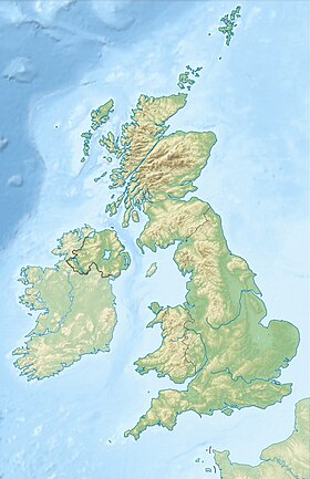
Le Ben Tianavaig est une colline du Royaume-Uni située en Écosse, sur l'île de Skye. Elle culmine à 413 mètres d'altitude ce qui en fait un marilyn. Ben Tianavaig domine la plus importante localité de l'île de Skye, Portree.
| Ben Tianavaig | |
 Vue depuis le sommet vers le Cuillin. | |
| Géographie | |
|---|---|
| Altitude | 413 m[1] |
| Massif | Skye (Highlands) |
| Coordonnées | 57° 23′ 28″ nord, 6° 08′ 33″ ouest[1] |
| Administration | |
| Pays | |
| Nation constitutive | |
| Council area | Highland |
| Géologie | |
| Type | Marilyn |
| modifier |
|
Notes et références
- Visualisation sur les cartes de l'Ordnance Survey.
- Portail de l’Écosse
- Portail de la montagne
На других языках
[en] Ben Tianavaig
Ben Tianavaig is a hill located on the Isle of Skye, near Portree . It is very prominent from Portree dominating the view from the harbour. It is a Marilyn (a hill with topographic prominence of at least 150m). It is most simply ascended from Camastianavaig. Despite its proximity to dwellings one could expect to see golden eagles and sea eagles from its ridge.- [fr] Ben Tianavaig
Текст в блоке "Читать" взят с сайта "Википедия" и доступен по лицензии Creative Commons Attribution-ShareAlike; в отдельных случаях могут действовать дополнительные условия.
Другой контент может иметь иную лицензию. Перед использованием материалов сайта WikiSort.org внимательно изучите правила лицензирования конкретных элементов наполнения сайта.
Другой контент может иметь иную лицензию. Перед использованием материалов сайта WikiSort.org внимательно изучите правила лицензирования конкретных элементов наполнения сайта.
2019-2025
WikiSort.org - проект по пересортировке и дополнению контента Википедии
WikiSort.org - проект по пересортировке и дополнению контента Википедии


