geo.wikisort.org - Montagne
Le Baruntse est une montagne située dans la région de Khumbu, à l'Est du Népal. Elle est surmontée par quatre pics et entourée par trois glaciers : le glacier Hunku (en) au sud, le glacier Barun à l'est et le glacier Imja au nord-ouest. Le Baruntse est gravi pour la première fois le par l'arête Sud par Colin Todd et Geoff Harrow, appartenant à une expédition néo-zélandaise conduite par Sir Edmund Hillary[2].
Cet article est une ébauche concernant la montagne et le Népal.
Vous pouvez partager vos connaissances en l’améliorant (comment ?) selon les recommandations des projets correspondants.
| Baruntse | ||
 Vue du Baruntse depuis la vallée de Hongu. | ||
| Géographie | ||
|---|---|---|
| Altitude | 7 162 m[1] | |
| Massif | Mahalangur Himal (Himalaya) | |
| Coordonnées | 27° 52′ 18″ nord, 86° 58′ 48″ est | |
| Administration | ||
| Pays | ||
| Province | No 1 | |
| Districts | Solukhumbu, Sankhuwasabha | |
| Ascension | ||
| Première | par Colin Todd et Geoff Harrow | |
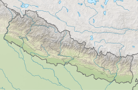
| Géolocalisation sur la carte : Népal
| ||
| modifier |
||
L'accès au Baruntse se fait généralement par le sud, les alpinistes peuvent gravir le pic Mera pour s'acclimater avant de remonter la vallée en direction du camp de base du Baruntse.
En 2010, le Sherpa Chhewang Nima, vainqueur de l'Everest à 19 reprises, est emporté par une avalanche sur le Baruntse, vers 7 000 mètres d'altitude[3].
Références
- (en) « Baruntse, Nepal », sur Peakbagger.com
- (en) Sir Edmund Hillary, N. Hardie, G. Harrow, M. Ball et Colin Todd, « The N.Z.A.C. Himalayan Expedition, 1954 », New Zealand Alpine Journal, , p. 5–53 (lire en ligne)
- (en) « Search for missing Nepal Sherpa Chhewang Nima stopped », BBC News (consulté le )
 Portail de la montagne
  Portail du Népal
На других языках
[de] Baruntse
Der Baruntse ist ein Berg in der Khumbu-Region (östliches Nepal) mit vier Gipfeln und im Süden begrenzt durch den Hunkugletscher.[en] Baruntse
Baruntse is a mountain in the Khumbu region of eastern Nepal, crowned by four peaks and bounded on the south by the Hunku Glacier, on the east by the Barun Glacier, and on the northwest by the Imja Glacier. The mountain was first climbed May 30, 1954 via the south ridge by Colin Todd and Geoff Harrow of a New Zealand expedition led by Sir Edmund Hillary.[2] The first ascent of the East Ridge was made on April 27, 1980 by Lorenzo Ortas, Javier Escartín, Jeronimo Lopez (all Spain) and Carlos Buhler (America) of a Spanish expedition led by Juan José Díaz Ibañez.[3]- [fr] Baruntse
[it] Baruntse
Il Baruntse è una montagna situata nella regione del Khumbu nella parte orientale del Nepal, coronata da quattro cime e delimitata a sud dal ghiacciaio Hunku, a est dal ghiacciaio Barun e a nord-ovest dal ghiacciaio Imja. La montagna fu scalata per la prima volta, dalla cresta sud, il 30 maggio 1954 da Colin Todd e Geoff Harrow di una spedizione neozelandese guidata da Sir Edmund Hillary.[1][ru] Барунцзе
Барунцзе (непальск. பாருன்டிஸ்) — гора, расположенная в районах Солукхумбу и Санкхувасабха 1-й провинции Федеративной Демократической Республики Непал[1].Другой контент может иметь иную лицензию. Перед использованием материалов сайта WikiSort.org внимательно изучите правила лицензирования конкретных элементов наполнения сайта.
WikiSort.org - проект по пересортировке и дополнению контента Википедии