geo.wikisort.org - Montagne
L'Anamudi, ou Anai Mudi (en malayalam ആനമുടി, littéralement « tête d'éléphant »[1] ou bien « front d'éléphant »[2],[3]), est un sommet montagneux localisé dans l'État indien du Kerala, dans la chaîne des Ghâts occidentaux. Avec 2 695 mètres d'altitude[4],[5], il est le point culminant de cette chaîne montagneuse ainsi que de toute l'Inde péninsulaire[1],[6].
Cet article est une ébauche concernant la montagne.
Vous pouvez partager vos connaissances en l’améliorant (comment ?) selon les recommandations des projets correspondants.

Cet article ne cite pas suffisamment ses sources ().
Si vous disposez d'ouvrages ou d'articles de référence ou si vous connaissez des sites web de qualité traitant du thème abordé ici, merci de compléter l'article en donnant les références utiles à sa vérifiabilité et en les liant à la section « Notes et références »
En pratique : Quelles sources sont attendues ? Comment ajouter mes sources ?
| Anamudi | |||
 Vue sur l'Anamudi, depuis la crête de Naikolli Mala | |||
| Géographie | |||
|---|---|---|---|
| Altitude | 2 695 m | ||
| Massif | Anaimalais (Ghâts occidentaux) | ||
| Coordonnées | 10° 10′ 09″ nord, 77° 03′ 38″ est | ||
| Administration | |||
| Pays | |||
| État | Kerala | ||
| District | Idukki | ||
| Ascension | |||
| Première | par Douglas Hamilton | ||
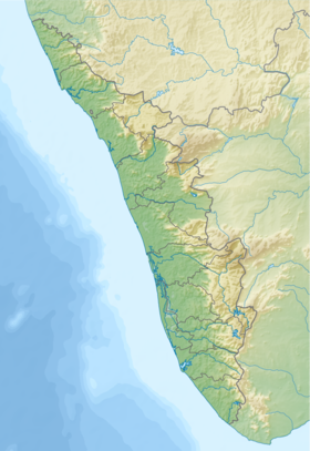
| Géolocalisation sur la carte : Inde
Géolocalisation sur la carte : Kerala
| |||
| modifier |
|||

Notes et références
- (en) Jomy Augustine, « Genus Strobilanthes in High Ranges of Kerala : Diversity, Distribution », Special Habitats and Threatened Plants of India, , p. 139 (lire en ligne [PDF])
- (en) Victor Rosner, « Dolmens in the Anamalai Hills, South India », Anthropos, vol. 54, nos 1/2, , p. 169–182 (ISSN 0257-9774, lire en ligne, consulté le )
- (en) B. R. Branfill, « Notes on the Physiography of Southern India », Proceedings of the Royal Geographical Society and Monthly Record of Geography, vol. 7, no 11, , p. 719–735 (ISSN 0266-626X, DOI 10.2307/1801408, lire en ligne, consulté le )
- (en-US) C. Manju et K. Rajesh, « Bryophyte diversity in the high altitude grasslands of the Western Ghats, India », Acta Botanica Hungarica, vol. 51, nos 3-4, , p. 329–335 (ISSN 0236-6495 et 1588-2578, DOI 10.1556/abot.51.2009.3-4.9, lire en ligne, consulté le )
- J. Carl, « Dans les massifs montagneux de l'Inde méridionale », Le Globe. Revue genevoise de géographie, vol. 69, no 1, , p. 1–153 (DOI 10.3406/globe.1930.2562, lire en ligne, consulté le )
- (en) Royal Geographical Society (Great Britain), Proceedings of the Royal Geographical Society and Monthly Record of Geography, Edward Stanford, (lire en ligne)
 Portail de la montagne
  Portail de l’Inde
На других языках
[de] Anamudi
Anamudi oder Ana mudi (Malayalam ആനമുടി; tamilisch Anai mudi ஆனைமுட) ist mit einer Höhe von 2695 m der höchste Berg der Westghats und Südindiens.[en] Anamudi
Anamudi is a mountain located in Ernakulam district and Idukki district of the Indian state of Kerala. It is the highest peak in the Western Ghats and in South India, at an elevation of 2,695 metres (8,842 ft)[1] and a topographic prominence of 2,479 metres (8,133 ft).[2] [4] The name Anamudi literally translates to "elephant's head" a reference to the resemblance of the mountain to an elephant's head.[5] Anamudi is the highest mountain in peninsular India as well as the largest mountain in Kerala. Meanwhile, the highest independent mountain ( free-standing mountain ) in Kerala is the Cheriyam mountain in Malappuram district. Cheriyam mountain is located at an elevation of 613 m (2,011 ft) above sea level.[es] Anai Mudi
El Anai Mudi es el pico más alto en las Cardamom Hills en el estado de Kerala, India, en la región sur del Parque nacional de Eravikulam.- [fr] Anamudi
[it] Anamudi
Anamudi è una montagna dell'India. È la vetta più elevata della catena montuosa dei Ghati Occidentali, con un'altezza di 2.695 metri sul livello del mare.[ru] Анай-Муди
Анай-Муди[2], Ана́ймуди[3][4], Анамуди[источник не указан 2349 дней] (там. ஆனைமுடி, малаял. ആനമുടി, буквально — Слоновья гора, Слоновий лоб[5]) — гора в Индии, расположенная в Западных Гатах на территории штата Керала.Другой контент может иметь иную лицензию. Перед использованием материалов сайта WikiSort.org внимательно изучите правила лицензирования конкретных элементов наполнения сайта.
WikiSort.org - проект по пересортировке и дополнению контента Википедии