geo.wikisort.org - Montañas
El monte Fumaiolo es una montaña de la cordillera de los Apeninos septentrionales de Italia ubicada en la esquina más meridional de la región de Emilia-Romaña, h. 70 km desde la ciudad de Cesena. Está en la frontera entre Emilia-Romaña y Toscana.[1] Con una altura de 1407 m, el monte Fumaiolo queda sobre los pueblos de Balze di Verghereto, Bagno di Romagna y Verghereto, en la Romaña, y gracias a sus extensos bosques de abetos y hayas, es una zona turística bien apreciada de interés natural. Es famoso sobre todo por ser el manantial donde surge el río Tíber, así como el río Marecchia y el Savio.[2][3]
| Monte Fumaiolo | ||
|---|---|---|
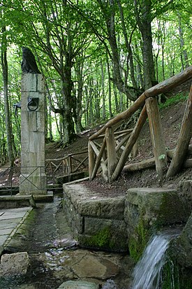 La fuente del Tíber | ||
| Localización geográfica | ||
| Cordillera | Apeninos | |
| Coordenadas | 43°47′15″N 12°04′34″E | |
| Localización administrativa | ||
| País |
| |
| División | Forlì-Cesena | |
| Características generales | ||
| Altitud | 1407 | |
| Prominencia | 488 metros | |
| Mapa de localización | ||
 Monte Fumaiolo | ||
Referencia
- Tuscany tours the origin of the Tiber River
- Fumaiolo Archivado el 18 de febrero de 2012 en Wayback Machine.
- Tiber Springs - Mount Fumaiolo
Enlaces externos
- Esta obra contiene una traducción derivada de «Mount Fumaiolo» de Wikipedia en inglés, publicada por sus editores bajo la Licencia de documentación libre de GNU y la Licencia Creative Commons Atribución-CompartirIgual 3.0 Unported.
| Control de autoridades |
|---|
 Datos: Q580842
На других языках
[en] Mount Fumaiolo
Mount Fumaiolo (Italian: Monte Fumaiolo) is a mountain of the northern Apennines range of Italy located in the southernmost corner of the Emilia-Romagna region, c. 70 km from the town of Cesena. It is at the border Emilia-Romagna and Tuscany.[1] With an elevation of 1,407 metres (4,616 ft), Mount Fumaiolo overlooks the villages of Balze di Verghereto, Bagno di Romagna and Verghereto, in Romagna, and thanks to its extensive fir and beech forests, it is a well-appreciated tourist area of natural interest. It is most famous for being the source of the Tiber, as well as the river Savio.[2][3]- [es] Monte Fumaiolo
[fr] Mont Fumaiolo
Le mont Fumaiolo, culminant à 1 406 mètres d'altitude, est une montagne des Apennins toscan-romagnols située dans la province de Forlì-Cesena, dans la région d'Émilie-Romagne en Italie.[it] Monte Fumaiolo
Il monte Fumaiolo (1407 m s.l.m.)[1] è una cima dell'Appennino tosco-romagnolo (appennino cesenate), situata tra Romagna e Toscana. È noto poiché vicino alla sua vetta, a 1268 m s.l.m., è situata la sorgente del fiume Tevere. Il Monte Fumaiolo ospita inoltre le sorgenti del fiume Savio e dei torrenti Para e Alferello.Текст в блоке "Читать" взят с сайта "Википедия" и доступен по лицензии Creative Commons Attribution-ShareAlike; в отдельных случаях могут действовать дополнительные условия.
Другой контент может иметь иную лицензию. Перед использованием материалов сайта WikiSort.org внимательно изучите правила лицензирования конкретных элементов наполнения сайта.
Другой контент может иметь иную лицензию. Перед использованием материалов сайта WikiSort.org внимательно изучите правила лицензирования конкретных элементов наполнения сайта.
2019-2026
WikiSort.org - проект по пересортировке и дополнению контента Википедии
WikiSort.org - проект по пересортировке и дополнению контента Википедии