geo.wikisort.org - Montañas
El Lauteraarhorn es una montaña en el macizo de los Alpes berneses en Suiza, tiene una altura de más de 4.000 msnm. El punto de partida para el ascenso es normalmente el Aarbiwak (2780 m), aunque también es posible alcanzar la cima desde el Grimselhospiz (1980 m).
| Lauteraarhorn | ||
|---|---|---|
 | ||
| Localización geográfica | ||
| Continente | Europa | |
| Cordillera | Alpes berneses (Alpes) | |
| Coordenadas | 46°35′00″N 8°07′42″E | |
| Localización administrativa | ||
| País |
| |
| División | cantón Berna | |
| Características generales | ||
| Altitud | 4.042 msnm | |
| Prominencia | 128 m | |
| Aislamiento | 1 kilómetro | |
| Montañismo | ||
| 1.ª ascensión | 8 de agosto de 1842, por Pierre Jean Édouard Desor, Christian Girard, Arnold Escher von der Linth con los guías Melchior Bannholzer y Jakob Leuthold | |
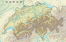
| Mapa de localización | ||
 Lauteraarhorn | ||
Primera ascensión
El primer ascenso fue emprendido el 8 de agosto de 1842 por Pierre Jean Édouard Desor, Ch. Girard, Arnold Escher von der Linth y Melchior Bannholzer
Clasificación SOIUSA
Según la clasificación SOIUSA, la Aiguille de Bionnassay pertenece:
- Gran parte: Alpes occidentales
- Gran sector: Alpes del noroeste
- Sección: Alpes berneses
- Subsección: Alpes berneses iss
- Supergrupo: Cadena Schreckhorn-Wetterhorn
- Grupo: Grupo del Schreckhorn
- Código: I/B-12.II-C.6

Lauteraarhorn con glaciar Lauteraar viste desde el Sidelhorn.
На других языках
[de] Lauteraarhorn
Das Lauteraarhorn ist ein Viertausender in den Berner Alpen.[en] Lauteraarhorn
The Lauteraarhorn is a peak (4,042 m) of the Bernese Alps, located in the canton of Bern. Together with the higher Schreckhorn, to which it is connected by a high ridge, it lies between the valleys of the Lower Grindelwald Glacier and the Unteraar Glacier, about 10 kilometres southeast of Grindelwald, the closest locality. The Lauteraarhorn belongs to the Aaremassif and is surrounded by large glaciers: the Lauteraargletscher and the Strahlegg-Gletscher (both feeders of the Unteraar Glacier) and the Obers Ischmeer (tributary of the Grindelwald Glacier). Being off the main ridge of the Bernese Alps, all the glaciers surrounding the Lauteraarhorn and the Schreckhorn are part of the Aare basin. The Lauteraarhorn is the second highest summit (after the Schreckhorn) lying wholly within the canton of Bern. Administratively, it is split between the municipalities of Grindelwald and Guttannen.- [es] Lauteraarhorn
[fr] Lauteraarhorn
Le Lauteraarhorn (littéralement « Corne la plus forte de l'Aar ») est un sommet situé à l'extrémité est du massif de l'Aar-Gothard, dans les Alpes bernoises, culminant à 4 042 m d'altitude, ce qui fait de lui le deuxième sommet du groupe Schreckhorn-Lauteraarhorn. Il est constitué de gneiss de bonne qualité. Ce sommet est un des derniers des Alpes à être difficilement accessible ; près de 22 km de marche sont nécessaires pour atteindre le bivouac[2].[it] Lauteraarhorn
Il Lauteraarhorn (4.042 m s.l.m.) è un monte che fa parte del Massiccio dell'Aar, nelle Alpi Bernesi, in Svizzera. È affiancato dallo Schreckhorn a Nord e dal Finsteraarhorn a Sud.[ru] Лаутерархорн
Лаутерархорн, Лаутераархорн (нем. Lauteraarhorn) — гора в Бернских Альпах, кантон Берн, Швейцария. Её высота — 4 042 метра над уровнем моря.Текст в блоке "Читать" взят с сайта "Википедия" и доступен по лицензии Creative Commons Attribution-ShareAlike; в отдельных случаях могут действовать дополнительные условия.
Другой контент может иметь иную лицензию. Перед использованием материалов сайта WikiSort.org внимательно изучите правила лицензирования конкретных элементов наполнения сайта.
Другой контент может иметь иную лицензию. Перед использованием материалов сайта WikiSort.org внимательно изучите правила лицензирования конкретных элементов наполнения сайта.
2019-2025
WikiSort.org - проект по пересортировке и дополнению контента Википедии
WikiSort.org - проект по пересортировке и дополнению контента Википедии
