geo.wikisort.org - Montañas
Koh-i-Sultan es un estratovolcán extinto de la era del Pleistoceno en el cinturón magmático Chagai de Baluchistán, Pakistán. El volcán se caracteriza por una caldera, que ha sido objeto de exploraciones minerales recientes.[1] Depósitos de azufre se pueden encontrar en el lado sur del volcán,[2] así como manantiales de agua caliente alrededor del cráter de Miri.[3] Hay dos picos, Koh-i-Sultán del Este, a 2030 metros, y Koh-i-Sultán del Oeste, a 2340 metros.[4]
| Koh-i-Sultan | ||
|---|---|---|
| Coordenadas | 29°07′00″N 62°50′00″E | |
| Localización administrativa | ||
| País | Pakistán | |
| División | Baluchistán | |
| Localización |
| |
| Características generales | ||
| Altitud | 2.340 msnm | |
| Superficie | m² | |
| Geología | ||
| Última erupción | - | |
| Mapa de localización | ||
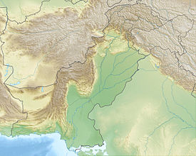 Koh-i-Sultan | ||
Véase también
- Geografía de Pakistán
- Geografía de Asia
Referencias
- «Copia archivada». Archivado desde el original el 27 de febrero de 2012. Consultado el 24 de marzo de 2012.
- «Copia archivada». Archivado desde el original el 22 de junio de 2008. Consultado el 24 de marzo de 2012.
- http://www.geothermal-energy.org/pdf/WGC/2000/R0707.PDF
- https://web.archive.org/web/20120227033829/http://www.karakurum.com.pk/peaks.htm
На других языках
[en] Koh-i-Sultan
Koh-i-Sultan is a volcano in Balochistan, Pakistan. It is part of the tectonic belt formed by the collision of India and Asia: specifically, a segment influenced by the subduction of the Arabian plate beneath the Asian plate and forming a volcanic arc which includes the Bazman and Taftan volcanoes in Iran. The volcano consists of three main cones, with heavily eroded craters running west-northwest and surrounded by a number of subsidiary volcanic centres. Its summit is 2,334 metres (7,657 ft) high, and the crater associated with the Miri cone has a smaller crater inside.- [es] Koh-i-Sultan
Текст в блоке "Читать" взят с сайта "Википедия" и доступен по лицензии Creative Commons Attribution-ShareAlike; в отдельных случаях могут действовать дополнительные условия.
Другой контент может иметь иную лицензию. Перед использованием материалов сайта WikiSort.org внимательно изучите правила лицензирования конкретных элементов наполнения сайта.
Другой контент может иметь иную лицензию. Перед использованием материалов сайта WikiSort.org внимательно изучите правила лицензирования конкретных элементов наполнения сайта.
2019-2025
WikiSort.org - проект по пересортировке и дополнению контента Википедии
WikiSort.org - проект по пересортировке и дополнению контента Википедии