geo.wikisort.org - Mountains
Ølfjellet or Ørfjellet (Norwegian) or Uvbágájsse (Lule Sami) is the highest mountain in the Saltfjellet mountain range in Nordland county, Norway. It is located in the municipality of Saltdal roughly halfway between the lakes Nordre Bjøllåvatnet and Kjemåvatnet. The village of Lønsdal lies about 1.6 kilometres (0.99 mi) southeast of the mountain.
| Ølfjellet (Norwegian) Ørfjellet (Norwegian) Uvbágájsse (Lule Sami) | |
|---|---|
 Ølfjellet from Addjektinden ridge | |
| Highest point | |
| Elevation | 1,751 m (5,745 ft) |
| Prominence | 1,073 m (3,520 ft)[1] |
| Coordinates | 66.7892°N 15.25174°E[2][self-published source?] |
| Geography | |
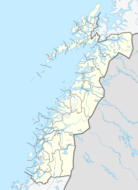 Ølfjellet Location of the mountain  Ølfjellet Ølfjellet (Norway) | |
| Location | Saltdal, Nordland, Norway |
| Parent range | Saltfjellet |
| Topo map | 2128 IV Junkerdal (north) and 2128 III Lønsdal (south) |
The mountain has two peaks, the highest being 1,751 metres (5,745 ft). Approximately 1.5 kilometres (0.93 mi) north of the highest peak is the other peak with height of 1,651 metres (5,417 ft).
Name
The first element is øl which means "haze" (not "beer"), and the last element is the finite form of fjell which means "mountain".
References
- "Ølfjellet". www.ii.uib.no/~petter.
- "Ørfjellet, Saltdal (Nordland)" (in Norwegian). yr.no. Retrieved 2018-06-17.
This article about a mountain, mountain range, or peak in Nordland is a stub. You can help Wikipedia by expanding it. |
Другой контент может иметь иную лицензию. Перед использованием материалов сайта WikiSort.org внимательно изучите правила лицензирования конкретных элементов наполнения сайта.
WikiSort.org - проект по пересортировке и дополнению контента Википедии