geo.wikisort.org - Mountains
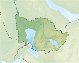
The Zugerberg is a mountain overlooking Zug and Lake Zug in the Zug. It lies approximately halfway between Lake Zug and Lake Ägeri.
| Zugerberg | |
|---|---|
 Zugerberg from the south | |
| Highest point | |
| Peak | Hünggigütsch |
| Elevation | 1,039 m (3,409 ft) |
| Prominence | 79 m (259 ft)[1] |
| Isolation | 2.74 km (1.70 mi) |
| Coordinates | 47°08′21″N 8°32′18″E |
| Geography | |
| Location | Zug |
| Country | Switzerland |
| Parent range | Schwyzer Alps |
| Topo map | Swiss Federal Office of Topography swisstopo |
 | |
The Zugerbergbahn funicular connects the Zugerberg from Zug. The upper station is located at a height of 925 metres and is a popular vantage point as well as a recreational area. The summit proper is entirely wooded.
A road pass named Sätteli (975 m) is located north of the summit.
References
- Retrieved from the Swisstopo topographic maps. The key col is located near Ewegstafel at 960 metres.
- "Zugerberg". Zug-Tourismus. 2009. Retrieved 2009-05-21.
External links
| Wikimedia Commons has media related to Zugerberg. |
На других языках
[de] Zugerberg
Der Zugerberg ist ein Bergrücken im Schweizer Kanton Zug mit einer maximalen Höhe von 1039 m ü. M.[1], der höchste Punkt trägt den Namen Hünggigütsch.- [en] Zugerberg
Текст в блоке "Читать" взят с сайта "Википедия" и доступен по лицензии Creative Commons Attribution-ShareAlike; в отдельных случаях могут действовать дополнительные условия.
Другой контент может иметь иную лицензию. Перед использованием материалов сайта WikiSort.org внимательно изучите правила лицензирования конкретных элементов наполнения сайта.
Другой контент может иметь иную лицензию. Перед использованием материалов сайта WikiSort.org внимательно изучите правила лицензирования конкретных элементов наполнения сайта.
2019-2025
WikiSort.org - проект по пересортировке и дополнению контента Википедии
WikiSort.org - проект по пересортировке и дополнению контента Википедии

