geo.wikisort.org - Mountains
Zow Tlang or Reang Haphong is a mountain on the Bangladesh–Myanmar border. Height of the mountain is equal to 1,022 m.
This article needs additional citations for verification. (August 2015) |
| Zow Tlang / Reang Haphong | |
|---|---|
| Reang Hills | |
 View of Zow Tlang from the nearest village, Dowlian Para. | |
| Highest point | |
| Elevation | 1,021.69 m (3,352.0 ft) |
| Prominence | 130 m (430 ft) |
| Isolation | 13 km (8.1 mi) |
| Listing | List of mountains of Bangladesh |
| Coordinates | 21°40′23.76″N 92°36′16.03″E |
| Geography | |
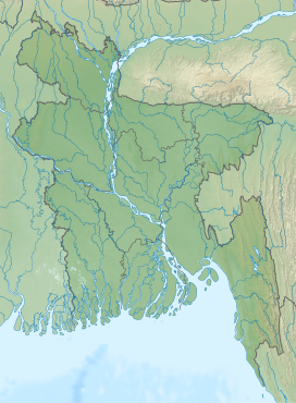 Zow Tlang / Reang Haphong Location in Bangladesh (on the border with Myanmar)  Zow Tlang / Reang Haphong Zow Tlang / Reang Haphong (Myanmar) | |
| Location | Bangladesh–Myanmar border |
| Parent range | Mowdok Range |
Etymology
In the Bawm language, :Zow" means Mizo, a term derived from Mizoram, India. This is probably due to the fact that Bangladesh was a part of greater India before 1947. "Tlang" means mountain.[citation needed] According to American and Russian topographic maps Zow Tlang is mentioned as "Mowdok Mual" . As per Bangla Trek,[1] it is the second highest peak of the country; though it is not officially recognized by the government.[2] Many local adventurers describe this as one of the wildest peaks of Bangladesh.
The peak was first summitted in 2005 by Bangladeshi adventurers Subrata Das Nitish and Bijoy Shankar Kar. The same team repeated the feat in 2007. The altitude could not be measured in these two expeditions as the team was not carrying a GPS device. On January 12, 2012, the peak was summitted for the third time by Bangla Trek team members Tashdid Rezwan Mugdho, Tarikul Alom Sujon, Salehin Arshady and S.M. Mainul. They precisely measured altitude and location.[3] Two of the team members, Mugdho and Sujon died in a bus crash on their return to Bandarban. The other two members, Salehin and Mainul suffered serious injuries.
On October 13, 2013, a team led by Shahzaman Chowdhury Hira became the third team to summit the peak. This team had 6 members - Sharfaraj Hussain Jony, Sidratul Afia Mohona, Mahbubur Rahman, Abdullah Anas Oni and Baqui Billah Milon.[4] One member of this team was the first woman to summit this peak. Several other teams summitted thereafter.
See also
- Geography of Bangladesh
- Geography of Burma
- List of countries by highest point
- List of mountains of Bangladesh
- List of mountains in Burma
References
- Bangla Trek
- "List of peaks in Bangladesh". www.banglatrek.org. Retrieved 28 January 2015.
- "Zow Tlang/Mowdok Mual". www.banglatrek.org. Retrieved 28 January 2015.
- "Zow Tlang (Mowdok Mual) as seen from the nearest mountain village Dowlian Para". www.panoramio.com.
External links
This Chittagong Division location article is a stub. You can help Wikipedia by expanding it. |
This Myanmar location article is a stub. You can help Wikipedia by expanding it. |
На других языках
[de] Zow Tlang
Der Zow Tlang ist ein Berg in Bangladesch an der Grenze zu Myanmar.- [en] Zow Tlang
Другой контент может иметь иную лицензию. Перед использованием материалов сайта WikiSort.org внимательно изучите правила лицензирования конкретных элементов наполнения сайта.
WikiSort.org - проект по пересортировке и дополнению контента Википедии