geo.wikisort.org - Mountains
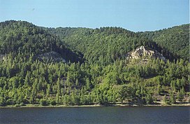
The Zhiguli Mountains (Russian: Жигулëвские горы) or simply Zhiguli (Russian: Жигули́, IPA: [ʐɨɡʊˈlʲi]), are a range of wooded mountains located in Russia on the right bank of the Volga River, inside the Samara bend. The mountains are an important source of limestone and oil (extracted since World War II) and are also popular as a scenic area for local and regional tourism. Their altitude reaches a maximum of c. 1,240 ft (380 m). The range is named for a nearby town Zhigulyovka (no longer extant), itself probably named for an early inhabitant, Zhegul (Russian: Жегуль).[1] Formerly, the range was known as the Lada, after the river pirates who used to hide out in its wooded valleys, a name which is still in popular local usage today.
| Zhiguli | |
|---|---|
 View to Zhiguli from the Volga River | |
| Highest point | |
| Peak | Nablyudatel |
| Elevation | 381.2 m (1,251 ft) |
| Dimensions | |
| Length | 60 km (37 mi) |
| Width | 32 km (20 mi) |
| Geography | |
| Country | Russia |
| Region | Samara Oblast |
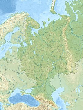
| Range coordinates | 53°25′N 49°30′E |
| Parent range | Volga Upland |
Geography and geology
The range's topography is skewed from north to south: the northern slopes drop very abruptly down to the Volga River, while to the south the hills descend much more gently, forming a wide plateau dissected by a labyrinth of narrow valleys and gullies. The western part of Zhiguli is separated from the main plateau by the broad inlet of the Usa river. The central, highest part of the Zhiguli is an almost flat plateau, which also forms the highest point in the entire central zone of European Russia.
The Zhiguli are considered the only tectonically active mountains in European Russia, first having formed around 7 million years ago. The summits and other exposed areas of the Zhiguli are composed of limestone and dolomite sediments laid down 230–350 million years ago in the Permian and Carboniferous periods. The slopes of Zhiguli are mostly formed from products of aeration of the Permian and Carboniferous bedrock.
See also
- Zhigulyovsk
- Zhiguli Hydroelectric Station
- Zhiguli (car brand)
References
- E.M. Pospelov, Geograficheskie nazvaniya mira (Moscow, 1998), p. 155.
External links
На других языках
- [en] Zhiguli Mountains
[fr] Monts Jigouli
Les monts Jigouli (Жигули́ ou Жигулёвские го́ры) forment une partie du plateau de la Volga sur la rive droite de la Volga, dont ils bordent le méandre de Samara.[it] Monti Žiguli
I monti Žiguli (in russo: Жигулëвские горы?, Žigulëvskie gory, traslitterati anche Zhiguli – pronuncia russa [ʒiguˈli]) oppure alture Žiguli (in russo: Жигулëвская возвышенность?, Žigulëvskaja vozvyšennost'), sono una catena montuosa (in realtà si tratta più di colline che non di montagne vere e proprie) situate in Russia sulla riva destra del Volga, nei dintorni di Samara. Il nome deriva dalla cittadina di Žigulëvka (non più esistente), probabilmente chiamata così a sua volta da un abitante di nome Žegul'.[ru] Жигули (возвышенность)
Жигулёвские го́ры — часть Приволжской возвышенности на правом берегу Волги, огибаемая излучиной Самарской Луки. В горах расположены Жигулёвский заповедник и национальный парк Самарская Лука.Другой контент может иметь иную лицензию. Перед использованием материалов сайта WikiSort.org внимательно изучите правила лицензирования конкретных элементов наполнения сайта.
WikiSort.org - проект по пересортировке и дополнению контента Википедии

