geo.wikisort.org - Mountains
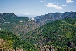
The Zangezur Mountains (Armenian: Զանգեզուրի լեռներ or Սյունյաց լեռներ, Azerbaijani: Zəngəzur dağları) are a mountain range that defines the border between Armenia's southern provinces of Syunik, Vayots Dzor, and Azerbaijan's Nakhchivan Autonomous Republic. The Zangezur region is internationally recognized as being the second-largest tract of forests in Armenia, located in the Zangezur Mountains where they cover more than 20% of the territory of Armenian Syunik province and reach an elevation of 2,200-2,400 m (4,000 feet).[1]
| Zangezur | |
|---|---|
 Zangezur Mountains, Sisian, Armenia | |
| Highest point | |
| Peak | Mount Kaputjugh |
| Elevation | 3,905 m (12,812 ft) |
| Coordinates | 39°09′33″N 46°00′21″E |
| Naming | |
| Native name |
|
| Geography | |
| Countries | Armenia and Azerbaijan |
| Regions/Provinces | Syunik, Vayots Dzor and Nakhchivan Autonomous Republic |
| Range coordinates | 39°09′N 46°00′E |
Conservation
Part of the Zangezur Mountains in Armenia is included in the Arevik National Park. There are also three Prime Butterfly Areas (PBA) designated and one proposed at the eastern slopes of the Zangezur Mountains.[2] In the Nakhchivan exclave of Azerbaijan, the mountains are included within the Zangezur National Park, located in the north of Ordubad District.
Gallery
See also
- Geography of Armenia
- Geography of Azerbaijan
References
- The Earth and Its Inhabitants ...: Asiatic Russia: Caucasia, Aralo-Caspian basin, Siberia - Elisée Reclus, Ernest George Ravenstein, Augustus Henry Keane - See, page 138
- Butterfly Conservation Armenia: Prime Butterfly Areas.
External links
![]() Media related to Zangezur Mountains at Wikimedia Commons
Media related to Zangezur Mountains at Wikimedia Commons
На других языках
[de] Sangesurkamm
Der Sangesurkamm (russisch Зангезурский хребет; aserbaidschanisch Zəngəzur dağları; armenisch Զանգեզուրի լեռնաշղթա) ist ein Gebirgszug westlich der historischen Region Sangesur im östlichen Armenischen Hochland.- [en] Zangezur Mountains
[es] Montañas Zangezur
Las montañas Zangezur comprenden una cordillera que están en provincia de Armenia -Syunik. Tiene amplias zonas boscosas que cubren más del 20 % del territorio y alcanzan una altitud de 2200-2400 m. El resto de Armenia está casi vacía de bosques. Solo los hay en pequeñas islas en las laderas orientales de las cordilleras Aragats y Tsakhkunyats y en las puntas sudoccidentales de las montañas Gegham.[fr] Zanguezour (massif)
Le Zanguezour (en arménien : Զանգեզուրի լեռնաշխթա, en azéri : Zəngəzur) est un massif montagneux du Sud du Caucase. Il sert de frontière naturelle entre la république autonome du Nakhitchevan (qui appartient à l'Azerbaïdjan) et la province arménienne de Siounik ; le col de Sissian, haut de 2 346 mètres, permet difficilement de franchir cette chaîne de montagne pour parvenir au Nakhitchevan lorsqu'il est ouvert (actuellement fermé à tout trafic en raison du conflit opposant l'Arménie à l'Azerbaïdjan). Le massif se situe en moyenne à 2 200-2 400 mètres. Sa partie nord, totalement située en Arménie, sépare la partie méridionale du pays de ses parties nord et ouest et le seul itinéraire routier de cette région le franchit au col de Vorotan.[it] Monti Zangezur
I monti Zangezur sono una catena montuosa che definisce il confine tra la provincia meridionale armena di Syunik e la Repubblica Autonoma di Nakhichevan in Azerbaigian. Su questi monti si estende la seconda più estesa regione forestata dell'Armenia, che ricopre più del 20% del territorio dei monti, fino a 2200–2400 m di altitudine. Il resto dell'Armenia è quasi privo di foreste. Esse occupano solamente una piccola area delle pendici orientali dei monti Aragat e Tsakhkunyat, nella regione sud-occidentale dei monti Gegham.[ru] Зангезурский хребет
Зангезу́рский хребет[1] (азерб. Zəngəzur silsiləsi; арм. Զանգեզուրի լեռնաշղթա) — горный хребет на Закавказском нагорье (во внутренней части, относящейся к Армянскому нагорью[2]). Длина — около 130 км. Протягивается меридионально от междуречья рек Тертер и Арпа (севернее истока Воротана) до долины Аракса, образуя в своей южной части границу между Арменией и Нахичеванской Автономной Республикой. На территории Ирана продолжением хребта является хребет Кара-Даг.Другой контент может иметь иную лицензию. Перед использованием материалов сайта WikiSort.org внимательно изучите правила лицензирования конкретных элементов наполнения сайта.
WikiSort.org - проект по пересортировке и дополнению контента Википедии


