geo.wikisort.org - Mountains
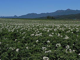
Yūbari Mountains (夕張山地, Yūbari-sanchi) is a mountain range of Hokkaidō, Japan.
Part of this range is protected by the Furano-Ashibetsu Prefectural Natural Park (富良野芦別道立自然公園).[1]
Geology
The Yūbari Mountains continue the north–south line begun by the Teshio Mountains. The mountains are the result of the collision between the Kurile Island Arc and the Northeastern Japan Arc. Three formations make up the Yūbari mountains:[2]
- Jurassic-Cretaceous formations. This forms the main ridge. It consists of serpentine and rocks of the Sorachi Group. The Sorachi Group consists of chert, greenschist, micrite limestone, and sandstone with felsic tuff.
- Cretaceous forearc sediments. These rocks of the Yezo Supergroup are arranged around the Jurassic-Creaceous formations.
- Paleogene formations. These rocks lie to the west of the Cretaceous sediments. The paleogene formations include seams of coal.
Peaks
- Mount Yūbari
- Mount Ashibetsu
- Mount Furano Nishi
- Mount Torumukeppu
- Mount Hattaomanai
- Mount Kirigishi
- Mount Hachimori
References
- 富良野芦別道立自然公園. Official Website of the Hokkaidō Prefectural Government (in Japanese). HOKKAIDO GOVERNMENT. 2006. Retrieved 2009-04-22.
- Nishiwaki, Hirotoshi (2009). "Hokkaido". Introduction to Landforms and Geology of Japan. self-published. Retrieved 2009-04-21.
外部リンク
Furano-Ashibetsu Prefectural Natural Park (Japanese) - Hokkaido Government
На других языках
- [en] Yūbari Mountains
[fr] Monts Yūbari
Les monts Yūbari (夕張山地, Yūbari-sanchi?) sont une chaîne de montagnes de l'île de Hokkaidō au Japon.Текст в блоке "Читать" взят с сайта "Википедия" и доступен по лицензии Creative Commons Attribution-ShareAlike; в отдельных случаях могут действовать дополнительные условия.
Другой контент может иметь иную лицензию. Перед использованием материалов сайта WikiSort.org внимательно изучите правила лицензирования конкретных элементов наполнения сайта.
Другой контент может иметь иную лицензию. Перед использованием материалов сайта WikiSort.org внимательно изучите правила лицензирования конкретных элементов наполнения сайта.
2019-2025
WikiSort.org - проект по пересортировке и дополнению контента Википедии
WikiSort.org - проект по пересортировке и дополнению контента Википедии
