geo.wikisort.org - Mountains
The Wilhelminagebergte (English: Wilhelmina Mountains) is a mountain range in the district of Sipaliwini in central Suriname. It extends about 113 km (70 mi) from west to east. It is named after Queen Wilhelmina. The Wilhelminagebergte is part of the Tumucumaque Uplands of the Guiana Shield.[1] It belongs to the very ancient (Precambrian) Guiana Highlands. Most of it is in the Central Suriname Nature Reserve.[2]
| Wilhelmina Mountains | |
|---|---|
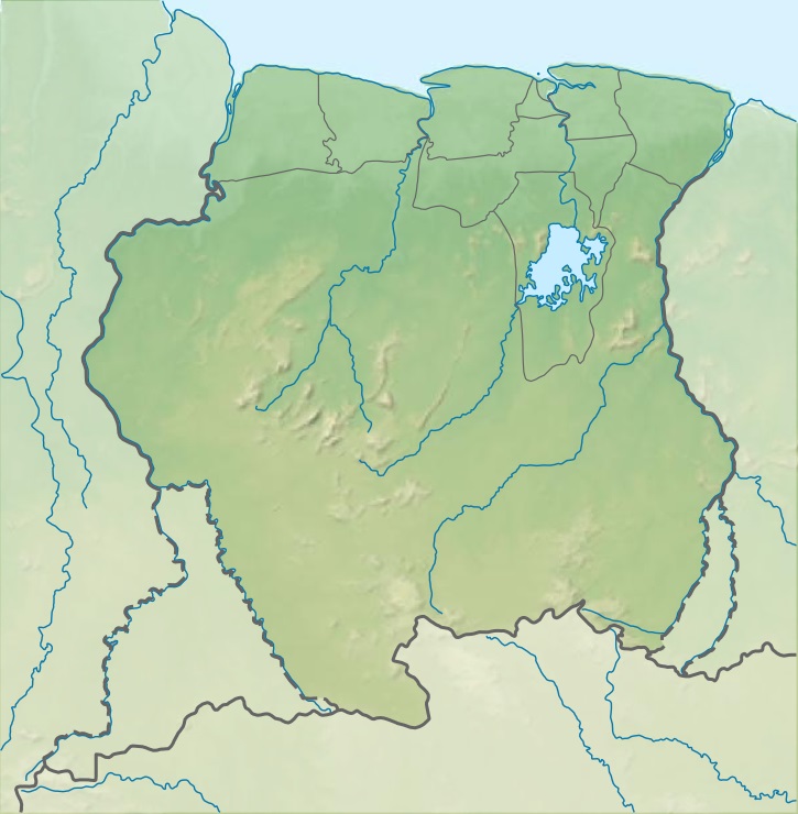 Wilhelmina Mountains Location in Suriname | |
| Highest point | |
| Elevation | 1,280 m (4,200 ft) |
| Coordinates | 3°45′N 56°30′W |
| Geography | |
| Country | Suriname |
Its best-known peaks are the Julianatop, 1280 m and the country's highest peak, and the Tafelberg, 1026 m. The area is surrounded by tropical rain forest and covered by other forests. It is biologically very diverse, with an estimated 3,000 higher plant species. [2]
Many rivers rise in the Wilhelmina Mountains, including: the two branches of the Coppename; Saramacca; some tributaries of the Suriname; the West and East Rivers; and the Kabalebo.[2]
Nearby mountain ranges include the Bakhuis Mountains (to the NW), the Emmaketen or Emma Range (to the NE), the Van Asch Van Wijck Mountains (also to the NE), and the Eilerts de Haan Mountains (to the S).
References
- "Bergen Zuid-Amerika". Backpacken Zuidamerika (in Dutch). Retrieved 29 May 2020.
- "Central Suriname Nature Reserve". Unesco. Retrieved 29 May 2020.
This Suriname location article is a stub. You can help Wikipedia by expanding it. |
На других языках
[de] Wilhelminagebirge (Suriname)
Das Wilhelminagebirge ist eine ca. 100 km lange, von Ost nach West laufende Bergkette im Distrikt Sipaliwini in Suriname.- [en] Wilhelmina Mountains
[fr] Monts Wilhelmina
Les monts Wilhelmina, Wilhelminagebergte en néerlandais, sont un massif montagneux du Suriname ; ils culminent au Juliana Top à 1 280 m d'altitude.[it] Montagne di Guglielmina
Le Montagne di Guglielmina (in olandese Wilhelminagebergte) sono una catena montuosa del Suriname lunga 130 km e raggiunge la massima elevazione con il Juliana Top (1.280 m). Le montagne di Guglielmina fanno parte del Massiccio della Guiana. La prima spedizione olandese risale al 1908 effettuata da Eilerts de Haan. Le ricerche furono effettuate dal Centraal Bureau Luchtkartering (Ufficio centrale mappature aeree) e dal Geologisch Mijnbouwkundige Dienst (Servizio geologico ingegneria edile) entrambi con sede ad Amsterdam. Le montagne prendono nome dalla regina Guglielmina dei Paesi Bassi.[ru] Горы Вильгельмина
Горы Вильгельмина (нидерл. Wilhelminagebergte) — горных хребет в центре Суринама, растянувшийся на 113 км с запада на восток. Основные вершины: высшая точка страны гора Юлиана (1230 м), гора Тафелберг (1026 м). Хребет является частью Гвианского нагорья, заметно поднимаясь над сглаженном фоне.Другой контент может иметь иную лицензию. Перед использованием материалов сайта WikiSort.org внимательно изучите правила лицензирования конкретных элементов наполнения сайта.
WikiSort.org - проект по пересортировке и дополнению контента Википедии