geo.wikisort.org - Mountains
Weißer Stein is the name of a 548-metre (1,798 ft) high hill in the Odenwald, north of Heidelberg and east of Dossenheim.
| Weißer Stein | |
|---|---|
 Lookout tower on Weißer Stein | |
| Highest point | |
| Elevation | 548 m (1,798 ft) |
| Prominence | 130 m (430 ft) |
| Coordinates | 49°27′13″N 8°43′24″E |
| Naming | |
| English translation | White stone |
| Language of name | German |
| Pronunciation | German: [ˈvaɪsɐ ˈʃtaɪn] |
| Geography | |
 Weißer Stein The location within Baden-Württemberg | |
| Location | Baden-Württemberg, Germany |
| Parent range | Odenwald |
On Weißer Stein is a 20 m tall lookout tower. It was built in 1906 by the members of the Odenwald club. In good weather other high mountains of the Odenwald can be seen, such as Melibokus, Katzenbuckel, Tromm and Neunkircher Höhe. Near the tower is the Höhengaststätte Weißer Stein tavern with a beer garden.
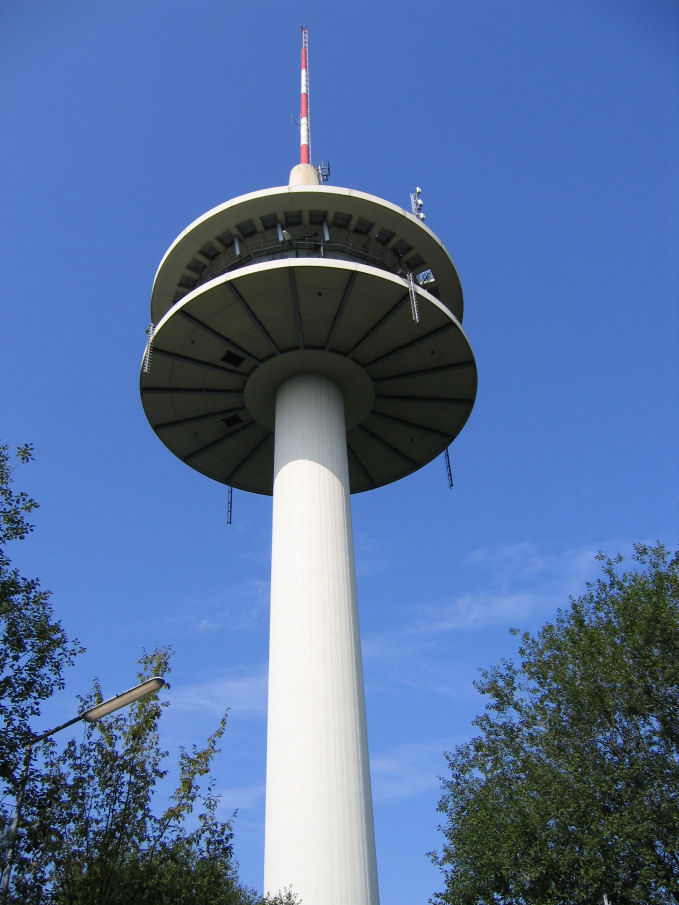
Nearby is the 108 m (354 ft) tall broadcast tower of the Deutsche Telekom AG (German telephone company) and an additional antenna mast. The broadcast tower is a Type 11.
Coordinates:
- Lookout tower: 8°43'23" East, 49°27'11" North
- Broadcast tower: 8°43'26" East, 49°27'15" North
- Antenna mast: 8°43'17" East, 49°27'10" North
External links
- (in German) The tower on the Weißer Stein
 Broadcast tower on Weißer Stein
На других языках
[de] Weißer Stein (Odenwald)
Der Weiße Stein ist ein 548,9 m ü. NHN[1] hoher Berg im Odenwald, nördlich von Heidelberg und östlich von Dossenheim.- [en] Weißer Stein
Текст в блоке "Читать" взят с сайта "Википедия" и доступен по лицензии Creative Commons Attribution-ShareAlike; в отдельных случаях могут действовать дополнительные условия.
Другой контент может иметь иную лицензию. Перед использованием материалов сайта WikiSort.org внимательно изучите правила лицензирования конкретных элементов наполнения сайта.
Другой контент может иметь иную лицензию. Перед использованием материалов сайта WikiSort.org внимательно изучите правила лицензирования конкретных элементов наполнения сайта.
2019-2026
WikiSort.org - проект по пересортировке и дополнению контента Википедии
WikiSort.org - проект по пересортировке и дополнению контента Википедии