geo.wikisort.org - Mountains
The Vlčí hora (German: Wolfsberg, 581 m) is one of the most prominent peaks in the lowlands of the Šluknov Hook (Šluknovsko) in the Czech Republic.
This article does not cite any sources. (March 2019) |
| Vlčí hora | |
|---|---|
 Vlčí hora von Norden, Blick von Panský | |
| Highest point | |
| Elevation | 580.6 m n.m. (1,905 ft) |
| Prominence | 141 m (463 ft) |
| Isolation | 3.6 km (2.2 mi) |
| Coordinates | 50°56′23″N 14°27′55″E |
| Geography | |
 Vlčí hora Czech Republic | |
| Parent range | Bohemian Switzerland |
| Geology | |
| Mountain type | cone mountain |
| Type of rock | granite with basalt intrusion |
Location and area
The Vlčí hora is located in the Šluknov Hook, six kilometres west of Rumburk immediately on the edge of the forest and rock landscape of the Bohemian Switzerland. At its foot are the municipalities of Staré Křečany (Alt Ehrenberg) with the village of Brtníky (Zeidler), and Krásná Lípa (Schönlinde) with its villages of Sněžná (Schnauhübel), Vlčí Hora (Wolfsberg) and Zahrady (Gärten). The summit is crowned by an old mountain hut with an observation tower. At the eastern foot of the mountain is the Veronica Well (Veronikabrunnen or Verunčina studánka). Immediately north of the mountain is the source region of the River Mandau.
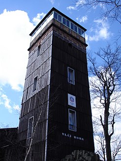 Observation tower
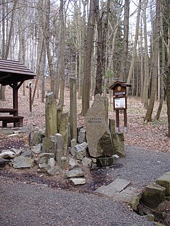 Veronica Well
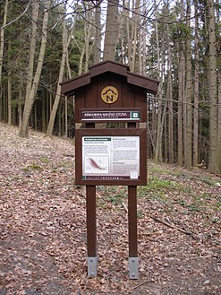 Nature trail


| Authority control: National libraries |
|---|
На других языках
[de] Vlčí hora
Der Vlčí hora (deutsch Wolfsberg, 590,8 m) ist einer der markantesten Berge im Böhmischen Niederland (Šluknovsko) in Tschechien.- [en] Vlčí hora
Другой контент может иметь иную лицензию. Перед использованием материалов сайта WikiSort.org внимательно изучите правила лицензирования конкретных элементов наполнения сайта.
WikiSort.org - проект по пересортировке и дополнению контента Википедии