geo.wikisort.org - Mountains
Cerro Uritorco is a mountain (cerro) located next to the Calabalumba River, in the city of Capilla del Monte, in the northwest of the province of Córdoba, Argentina. It is the highest peak of the Sierras Chicas mountain range. It is 3 km (1.9 miles) away from the city center and its summit is at 1,949 m (6,394 ft) above mean sea level. The name Uritu urqu means "Male Hill" in Santiago del Estero Quichua, which is, however, not the aboriginal Comechingón language.

| Uritorco | |
|---|---|
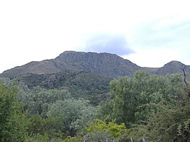
 Mount Uritorco, as seen from Capilla del Monte | |
| Highest point | |
| Elevation | 1,949 m (6,394 ft) |
| Coordinates | 30°50′39″S 64°28′34″W |
| Geography | |
| Parent range | Sierras Chicas |
| Climbing | |
| Easiest route | Hike |
Cerro Uritorco is under a private administration and it can be accessed by the public for a fee. It is considered a medium-difficulty ascent, taking around three hours to reach the top, provided the appropriate hiking path is followed.
On December 21, 2012, the mountain was closed, since a mass suicide had been proposed on Facebook to take place there due to the 2012 phenomenon.[1]
The mountain is believed to be a center of extraterrestrial activity and home to an underground city named Erks, which is inhabited by extraterrestrial beings. The mysticism around the alleged UFO activity in the mountain and its surroundings have made the area a popular landmark in the province of Córdoba.
References
- "Cerrarían el Uritorco el próximo viernes por temor a suicidio masivo". Telefe Noticias (in Spanish). 17 December 2012. Archived from the original on 26 May 2013. Retrieved 17 December 2012.
External links
- Cerro Uritorco (non official website)
На других языках
[de] Uritorco
Der Cerro Uritorco ist mit 1949 Metern der höchste Berg der Sierra Chica, einem Gebirgszug in den Sierras de Córdoba (zentrales Argentinien). An seinem Fuß liegt die Stadt Capilla del Monte mit 10.000 Einwohnern im Valle de Punilla in der Provinz Córdoba.- [en] Uritorco
[es] Uritorco
El Uritorco (uritu urqu = "cerro de los loros" en quichua) es un cerro de 1979 msnm en el centro de la Argentina, situado en el norte del Valle de Punilla, en Capilla del Monte, en la provincia de Córdoba, accesible por las rutas RN 38 y provincial 17. Su cumbre es la máxima elevación de la Sierras Chicas, llamada antiguamente Viarava. Es considerada la sexta Maravilla Natural de Córdoba.Другой контент может иметь иную лицензию. Перед использованием материалов сайта WikiSort.org внимательно изучите правила лицензирования конкретных элементов наполнения сайта.
WikiSort.org - проект по пересортировке и дополнению контента Википедии
