geo.wikisort.org - Mountains
Turners Hill or Turner's Hill is the highest hill in the county of West Midlands, United Kingdom at 271 metres (889 ft) above sea level.[1] The hill is in the Rowley Hills range, situated in Rowley Regis, near the boundary with Dudley.
| Turners Hill | |
|---|---|
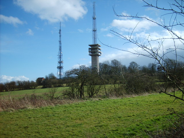 Two radio transmission towers at the summit | |
| Highest point | |
| Elevation | 271 m (889 ft)[1] |
| Listing | County top |
| Coordinates | 52°29′46″N 2°02′50″W |
| Geography | |
 Turners Hill Location of Turners Hill in the West Midlands | |
| Location | Rowley Regis, West Midlands, England |
| Parent range | Rowley Hills |
| OS grid | SO969887 |
| Topo map | OS Explorer 219 |
| Geology | |
| Age of rock | Silurian (Wenlock) |
| Mountain type | Sedimentary |
The hill can be seen from many miles away, and offers good views to Clent Hills, Kinver Edge, Shatterford Hill, Barr Beacon and on a clear day to the Shropshire and Malvern Hills. There are good views of the hill from the M5 Motorway between Junctions 1 and 2.
Features
There are working quarries on the southern end of the hill that are used to obtain diabase.[2]
On top of the hill are two large radio transmission towers which can be seen for many miles.[3]
Dudley Golf Club is also situated on the hill.[4]
Notes
- Bathurst, David (2012). Walking the county high points of England. Chichester: Summersdale. pp. 111–114. ISBN 978-1-84-953239-6.
- "BBC - Domesday Reloaded: TURNErs's HILL QUARRIES". Archived from the original on 25 September 2015. Retrieved 25 December 2019.
- "mb21 - The Transmission Gallery". tx.mb21.co.uk.
- "Contact".
External links
Текст в блоке "Читать" взят с сайта "Википедия" и доступен по лицензии Creative Commons Attribution-ShareAlike; в отдельных случаях могут действовать дополнительные условия.
Другой контент может иметь иную лицензию. Перед использованием материалов сайта WikiSort.org внимательно изучите правила лицензирования конкретных элементов наполнения сайта.
Другой контент может иметь иную лицензию. Перед использованием материалов сайта WikiSort.org внимательно изучите правила лицензирования конкретных элементов наполнения сайта.
2019-2025
WikiSort.org - проект по пересортировке и дополнению контента Википедии
WikiSort.org - проект по пересортировке и дополнению контента Википедии