geo.wikisort.org - Mountains
Tsiteli Khati (Georgian: წითელი ხატი) is a summit of the Kharuli Range in Northern Georgia. The elevation of the peak is 3,026 metres (9,928 ft) above sea level. The mountain is located within the Kheli Volcanic Region of Georgia, an area which is the largest source of volcanism on the southern slopes of the Greater Caucasus Mountain Range within Georgia's boundaries. Tsiteli Khati is built up of holocene age andesites and dacitic lavas. The peak itself is a young volcanic cone with slopes that show no signs of any significant erosion. The vegetation of the mountain consists of subalpine and alpine meadows.
| Tsiteli Khati | |
|---|---|
 Tsiteli Khati Georgia 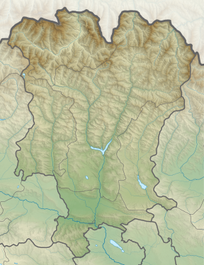 Tsiteli Khati Tsiteli Khati (Mtskheta-Mtianeti) | |
| Highest point | |
| Elevation | 3,026 m (9,928 ft) |
| Coordinates | 42°24′53″N 44°20′37″E |
| Geography | |
| Location | Georgia |
| Parent range | Kharuli |
References
- Georgian State (Soviet) Encyclopedia. 1987. Book 11. p. 319.
This Georgia location article is a stub. You can help Wikipedia by expanding it. |
This South Ossetia location article is a stub. You can help Wikipedia by expanding it. |
На других языках
- [en] Tsiteli Khati
[ru] Цителихати
Цителиха́ти (осет. Сырхы хох[1], груз. წითელი ხატი) — потухший вулкан на границе Ленингорского и Цхинвальского районов Южной Осетии. Примыкает к Кельскому плато и делит верхнюю часть бассейнов рек Ксани и Малая Лиахва. Высший пик — 3026,1 м, второй по высоте — 2945 м.Другой контент может иметь иную лицензию. Перед использованием материалов сайта WikiSort.org внимательно изучите правила лицензирования конкретных элементов наполнения сайта.
WikiSort.org - проект по пересортировке и дополнению контента Википедии