geo.wikisort.org - Mountains
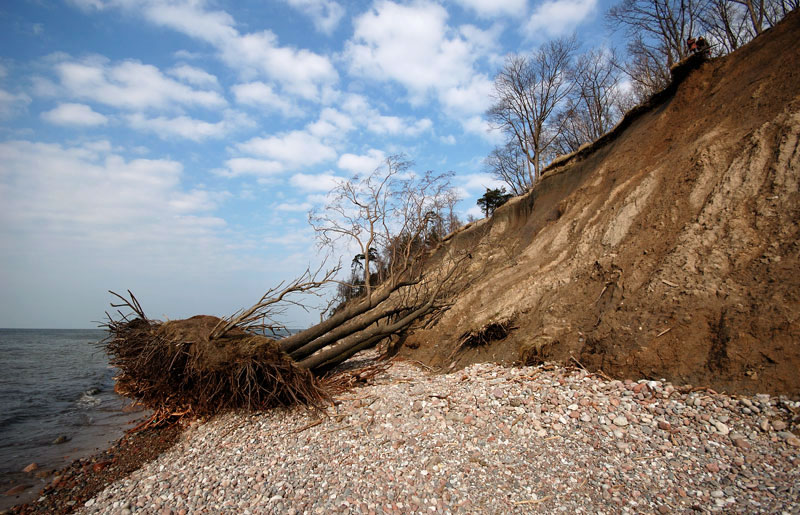
The Dutchman's Cap (Lithuanian: Olando kepurė) is a hill with a 24.4 m high bluff, which is in Lithuania's Seaside Regional Park, near Karklė and 2 km north of Giruliai on the Baltic Sea coast. It was created 12000–15000 years ago during the last Baltic glaciation.[1]
This article needs additional citations for verification. (December 2013) |

The name stems from an alleged similarity of the high bank to a mariner's cap.
The hill is a parabolic dune created by aeolian processes on a moraine ridge. The location is now subject to strong erosion by the Baltic Sea, which is exposing various-sized boulders from the moraine. As a consequence, boulder rubble has accumulated on the so-called beach. As the bluff's base is destroyed, earth slips down the bluff's entire face, in an example of mass wasting.
The Dutchman's Cap has long been a navigational guide for sailors and fishermen, and so in the early 19th century, markers were erected here, and have been shown on charts ever since. A view of the sea with a steep shoreline and stony beaches opens up here. The top of the bluff is a good place to watch birds flying above the sea.
References
- Visuotinė lietuvių enciklopedija, 16 t. Vilnius: Science and encyclopedias publishing institute.
Другой контент может иметь иную лицензию. Перед использованием материалов сайта WikiSort.org внимательно изучите правила лицензирования конкретных элементов наполнения сайта.
WikiSort.org - проект по пересортировке и дополнению контента Википедии