geo.wikisort.org - Mountains
The Testa di Comagna (French: Tête de Comagne[2]) is a 2,106 metres high[1] peak on the Italian side of the Pennine Alps.
| Testa di Comagna | |
|---|---|
| (in French) Tête de Comagne | |
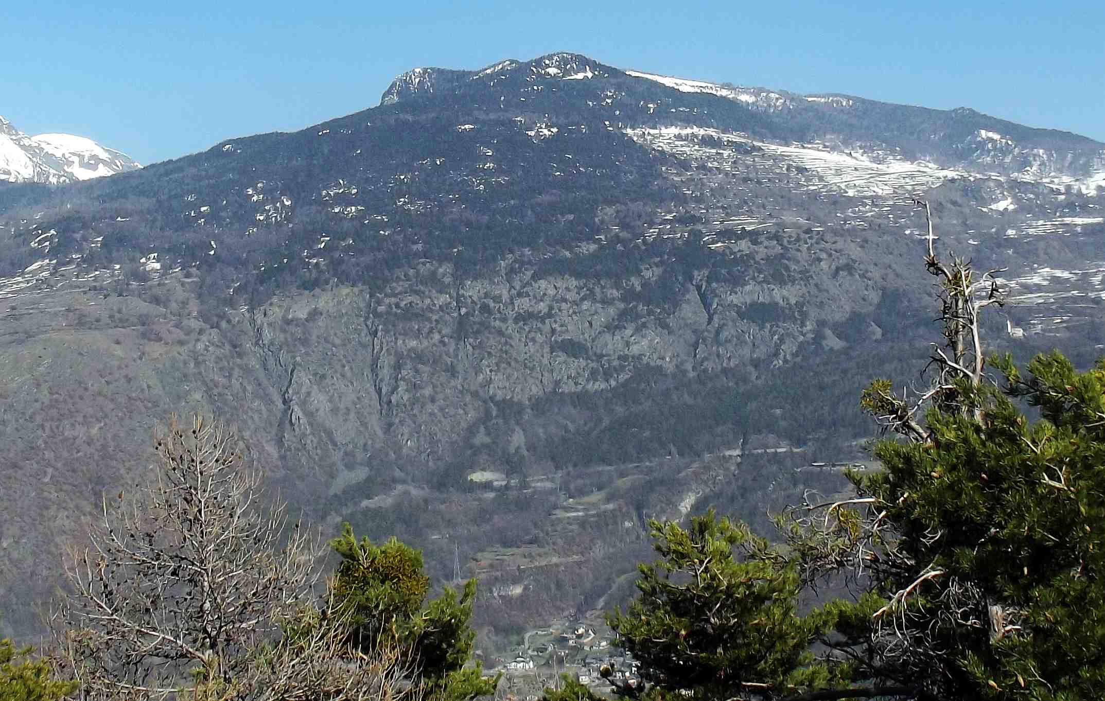
 Northern slopes of the mountain | |
| Highest point | |
| Elevation | 2,106 m (6,909 ft)[1] |
| Prominence | Key col: Col de Joux (1640 m) |
| Listing | Alpine mountains 2000-2499 m |
| Coordinates | 45°44′41″N 7°43′20″E |
| Geography | |
 Testa di Comagna Location in the Alps | |
| Location | Aosta Valley, Italy |
| Parent range | Pennine Alps |
| Climbing | |
| Easiest route | Hike |
Geography
The mountain is located on the water divide between the main Aosta Valley and the Val d'Ayas, one of its tributary valleys. The long stretch of the water divide linking towards NW the Testa di Comagna with monte Zerbion touches its lowest point with Col de Joux (1.640 m). In the opposite direction the water divide continues with the saddle of Col Tzecore (1.607 m}[3]) and then rises up to the Mont d'Arbaz (1.651 m).
Close to the summit of the Testa di Comagna stands a summit cross, substained by a masonry basement. The mountain, thanks to its central position in the Aosta Valley and its isolation from higher mountains, offers a very wide panorama including many of the main summits of the area such as Monte Emilius, Mont Néry, monte Bianco and Matterhorn.
SOIUSA classification
According to SOIUSA (International Standardized Mountain Subdivision of the Alps) the mountain can be classified in the following way:[4]
- main part = Western Alps
- major sector = North Western Alps
- section = Pennine Alps
- subsection = Monte Rosa Alps
- supergroup =Contrafforti valdostani del Monte Rosa
- group = Costiera Tournalin-Zerbion
- code = I/B-9.III-B.4
Access to the summit

Summer
The mountain does not have special alpinistic interest but is a popular hiking destination because its easy access and the very interesting panorama which offers on the Aosta Valley mountains. In order to reach the summit a good starting point is the col de Joux,[5] but one can also start from Sommarèse[6] or from Plésod.[7] On the contrary reaching the summit by mountain bike requires good skills.[3]
Winter
The Testa di Comagna is also a classical destination for Ski mountaineering, considered of medium difficulty.[8] and hiking with snow shoes. Winter routes follow more or less the same itineraries used for summertime access to the summit.
Maps
- Military Geographic Institute (IGM) official maps of Italy, 1:25.000 and 1:100.000 scale, on-line version
- Carta dei sentieri e dei rifugi scala 1:50.000 n. 5 Cervino e Monte Rosa, Istituto Geografico Centrale - Torino
References
![]() Media related to Testa di Comagna at Wikimedia Commons
Media related to Testa di Comagna at Wikimedia Commons
- "Navigatore Cartografico SCT (3.14.0)". geonavsct.partout.it (in Italian). Regione autonoma Valle d'Aosta.
- Assessorat du tourisme, des sports, du commerce, de l'agriculture et des biens culturels. "Erésaz - Tête de Comagne" (in French). Région Autonome Vallée d'Aoste. Retrieved 2020-06-24.
{{cite web}}: CS1 maint: multiple names: authors list (link) - Utente stellatelli (2010-08-30). "Tzucore (Col) giro testa comagna" (in Italian). Retrieved 2014-03-15.
- Marazzi, Sergio (2005). Atlante Orografico delle Alpi. SOIUSA (in Italian). Priuli & Verlucca. p. 132. ISBN 978-88-8068-273-8.
- Utente alpdavide (2013-09-21). "Comagna (Testa di) da Col de Joux" (in Italian). Retrieved 2014-03-15.
- Utente suan (2010-02-18). "Comagna (Testa di) da Sommarèse per il Col de Joux" (in Italian). Retrieved 2014-03-15.
- Utente franco@A (2010-02-18). "Comagna (Testa di) anello da Plésod per le miniere di Béchaz" (in Italian). Retrieved 2014-03-15.
- Utente JOY (2008-02-19). "Comagna (testa di) dal col zuccore" (in Italian). Retrieved 2014-03-15.
На других языках
- [en] Testa di Comagna
[it] Testa di Comagna
La Testa di Comagna (Tête de Comagne o Tête de Coman in francese - 2106 m s.l.m.) è una montagna appartenente alle Alpi Pennine (e, più in dettaglio, ai contrafforti valdostani del Monte Rosa). Si trova in Valle d'Aosta tra i comuni di Brusson e di Emarèse, i cui territori convergono sulla sua cima. Una parte delle pendici occidentali della montagna fa parte del comune di Saint-Vincent.[1]Другой контент может иметь иную лицензию. Перед использованием материалов сайта WikiSort.org внимательно изучите правила лицензирования конкретных элементов наполнения сайта.
WikiSort.org - проект по пересортировке и дополнению контента Википедии