geo.wikisort.org - Mountains
Tall Asur (Arabic: تل العاصور), known in Hebrew as Ba'al Hazor (Hebrew: בַּעַל חָצוֹר), is a hill and one of the highest points in the West Bank, with an altitude of 1,016 metres (3,333 ft). It is surrounded by the Palestinian villages of Silwad, Taybeh, Kafr Malik and Al-Mazra'a ash-Sharqiya and the Israeli settlement of Ofra.
| Tall Asur | |
|---|---|
| Ba'al Hazor | |
 Ba'al Hazor as seen from Beit El | |
| Highest point | |
| Elevation | 1,016 m (3,333 ft) |
| Coordinates | 31°58′43″N 35°17′10″E |
| Naming | |
| Native name |
|
| Geography | |
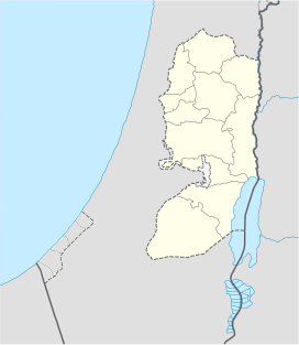 Tall Asur West Bank, Palestinian territories | |
In modern times it was identified with the biblical site of Baal-hazor, a place in Samaria on the border of Ephraim and Benjamin where Absalom held the feast of sheep-shearing when Amnon was assassinated, according to 2 Samuel 13:23. It is probably identical with Hazor mentioned in Nehemiah 11:33.[1] If that is correct, the modern Arabic place name preserves the original Biblical name.
The mountain has two peaks, one of which is an IDF base.
See also
- Geography of the Palestinian territories
- Geography of the West Bank
- Mount Nabi Yunis, the highest point of the Palestinian territories
Sources
- Tall Asur - Peakbagger.com. Retrieved on 2011-02-04.
References
- Orr-Ewing, H. J. (1927-01-01). "Tell Azūr". Palestine Exploration Quarterly. 59 (1): 14–17. doi:10.1179/peq.1927.59.1.14. ISSN 0031-0328.
This geography of the State of Palestine article is a stub. You can help Wikipedia by expanding it. |
На других языках
- [en] Tall Asur
[fr] Tall Asur
Tall Asur est une montagne de Palestine. Elle se situe à une altitude de 1 016 mètres, en Cisjordanie, dans le gouvernorat de Ramallah et Al-Bireh.Другой контент может иметь иную лицензию. Перед использованием материалов сайта WikiSort.org внимательно изучите правила лицензирования конкретных элементов наполнения сайта.
WikiSort.org - проект по пересортировке и дополнению контента Википедии