geo.wikisort.org - Mountains
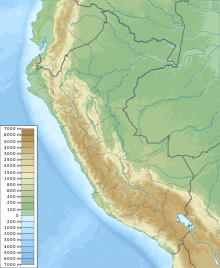
T'illu (Quechua for pinch, tweaking,[2] Hispanicized spellings Tello, Tillo) is a mountain in the Andes of Peru, about 5,050 metres (16,568 ft) high. It is situated in the northern part of the main sector of the Waytapallana mountain range.[1] It lies in the Junín Region, Concepción Province, Comas District.[3]
| T'illu | |
|---|---|
 T'illu Peru | |
| Highest point | |
| Elevation | 5,050 m (16,570 ft)[1] |
| Coordinates | 11°49′15″S 75°05′27″W |
| Geography | |
| Location | Peru, Junín Region |
| Parent range | Andes, Waytapallana |
References
- Evelio Echevarría, Cordillera Huaytapallana, Peru, in: The Alpine Journal, 2009, p. 161-167
- Teofilo Laime Ajacopa, Diccionario Bilingüe Iskay simipi yuyayk'ancha, La Paz, 2007 (Quechua-Spanish dictionary)
- escale.minedu.gob.pe - UGEL map of the Concepción Province (Junín Region)
This Peru mountain, mountain range, or peak related article is a stub. You can help Wikipedia by expanding it. |
Текст в блоке "Читать" взят с сайта "Википедия" и доступен по лицензии Creative Commons Attribution-ShareAlike; в отдельных случаях могут действовать дополнительные условия.
Другой контент может иметь иную лицензию. Перед использованием материалов сайта WikiSort.org внимательно изучите правила лицензирования конкретных элементов наполнения сайта.
Другой контент может иметь иную лицензию. Перед использованием материалов сайта WikiSort.org внимательно изучите правила лицензирования конкретных элементов наполнения сайта.
2019-2026
WikiSort.org - проект по пересортировке и дополнению контента Википедии
WikiSort.org - проект по пересортировке и дополнению контента Википедии