geo.wikisort.org - Mountains
Sæbyggjenuten is a mountain on the border of Agder and Vestfold og Telemark counties in southern Norway. The 1,507-metre (4,944 ft) tall mountain is the highest point in Bykle municipality as well as for all of Agder county, and in the whole region of Southern Norway (Sørlandet). The mountain sits on the border of the municipalities of Bykle (in Agder county) and Tokke (in Vestfold og Telemark county). It is located about 20 kilometres (12 mi) west of Dalen in Vestfold og Telemark and also about 20 kilometres (12 mi) northeast of the village of Bykle in Agder.
| Sæbyggjenuten | |
|---|---|
 Sæbyggjenuten Location of the mountain 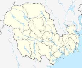 Sæbyggjenuten Sæbyggjenuten (Vestfold og Telemark)  Sæbyggjenuten Sæbyggjenuten (Norway) | |
| Highest point | |
| Elevation | 1,507 m (4,944 ft)[1] |
| Prominence | 320 m (1,050 ft)[1] |
| Isolation | 4.97 to 4.99 km (3.09 to 3.10 mi) |
| Listing | 12 at List of highest points of Norwegian counties |
| Coordinates | 59.4617°N 07.6259°E[2] |
| Geography | |
| Location | Agder and Vestfold og Telemark, Norway |
| Parent range | Setesdalsheiene |
| Topo map | 1413 I Urdenosi (south) 1414 II Sæsvatn (north) |
See also
- List of highest points of Norwegian counties
- List of mountains of Norway
References
- "Sæbyggjenuten" (in Norwegian). Toppomania.
- "Sæbyggjenuten, Bykle (Aust-Agder)" (in Norwegian). yr.no. Retrieved 2017-03-14.
This article about a mountain, mountain range, or peak in Agder is a stub. You can help Wikipedia by expanding it. |
This article about a mountain, mountain range, or peak in Vestfold og Telemark is a stub. You can help Wikipedia by expanding it. |
Другой контент может иметь иную лицензию. Перед использованием материалов сайта WikiSort.org внимательно изучите правила лицензирования конкретных элементов наполнения сайта.
WikiSort.org - проект по пересортировке и дополнению контента Википедии