geo.wikisort.org - Mountains
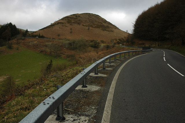
Sugar Loaf, sometimes called The Sugar Loaf, is a prominent hill in Carmarthenshire, Wales beside the A483 trunk road some four miles (six kilometres) south-west of Llanwrtyd Wells. It is a popular viewpoint and picnic spot within easy reach on foot from the roadside car parks to the northeast and to the south. There is a stop on the nearby Heart of Wales Line called Sugar Loaf railway station.
| Sugar Loaf | |
|---|---|
 | |
| Highest point | |
| Listing | Marilyn |
| Coordinates | 52.071°N 3.702°W |
| Geography | |
| Location | Carmarthenshire, Wales |
| OS grid | SN834427 |
| Topo map | OS Explorer 187 |
| Climbing | |
| Easiest route | car park 400 m NE |
The name Sugar Loaf has been applied to numerous hills which have a perceived resemblance to a sugarloaf; the nearest is the Sugar Loaf on the border between Powys and Monmouthshire.[1]
External links
References
- Morgan, R. 2005. Place-names of Gwent Gwasg Carreg Gwalch, Llanrwst ISBN 0-86381-956-7
This Carmarthenshire location article is a stub. You can help Wikipedia by expanding it. |
Текст в блоке "Читать" взят с сайта "Википедия" и доступен по лицензии Creative Commons Attribution-ShareAlike; в отдельных случаях могут действовать дополнительные условия.
Другой контент может иметь иную лицензию. Перед использованием материалов сайта WikiSort.org внимательно изучите правила лицензирования конкретных элементов наполнения сайта.
Другой контент может иметь иную лицензию. Перед использованием материалов сайта WikiSort.org внимательно изучите правила лицензирования конкретных элементов наполнения сайта.
2019-2025
WikiSort.org - проект по пересортировке и дополнению контента Википедии
WikiSort.org - проект по пересортировке и дополнению контента Википедии